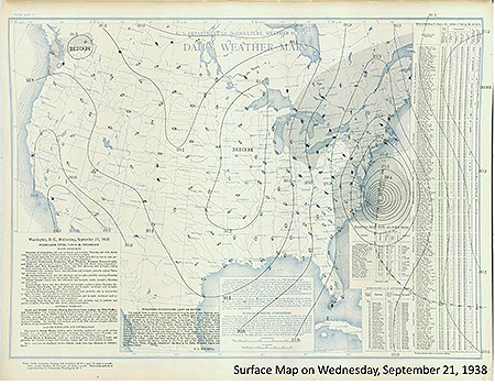
Eighty years ago today (September 21st), the Great New England Hurricane of 1938 ripped across New York’s Long Island and slammed into the Northeast, killing more than 600 people and clawing its way across New England and the record books. Every hurricane to strike the region since is compared to this behemoth, and none has come close to its devastating intensity.

Ferocious winds gusting beyond category 5 intensity and an enormous storm surge that wiped out coastal Long Island and flooded into Rhode Island and Connecticut were its hallmarks. Copious rains also brought by the hurricane fell on soils swamped by heavy rain just days before the storm, leading to widespread flooding and thousands of landslides. Eight decades. And its imprint is still being realized.
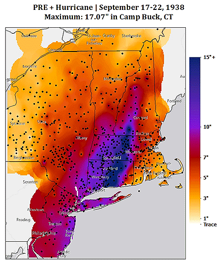
Recently, new precipitation data on the storm and a precursor heavy rain event—now understood to be ubiquitous before New England hurricanes—were found. This precipitation map (right) newly appears in the 2nd edition of Taken by Storm 1938: a comprehensive social and meteorological history of the Great New England Hurricane, by Lourdes B. Avilés, professor of meteorology at Plymouth State University.

(U.S. Geological Survey)
The map was created by a grad student Avilés was advising—Lauren Carter—who painstakingly digitized thousands of observations from more than 700 daily weather stations Avilés had unearthed, spanning the 6-day event. This unique updated rainfall map is just one of many new and interesting finds detailed in the new edition of her book, which is now available in the AMS Bookstore. The book’s website houses supplemental information, including more color rainfall maps, detailed reports, and photos.