A Few Takeaways from the “State of the Climate in 2022”

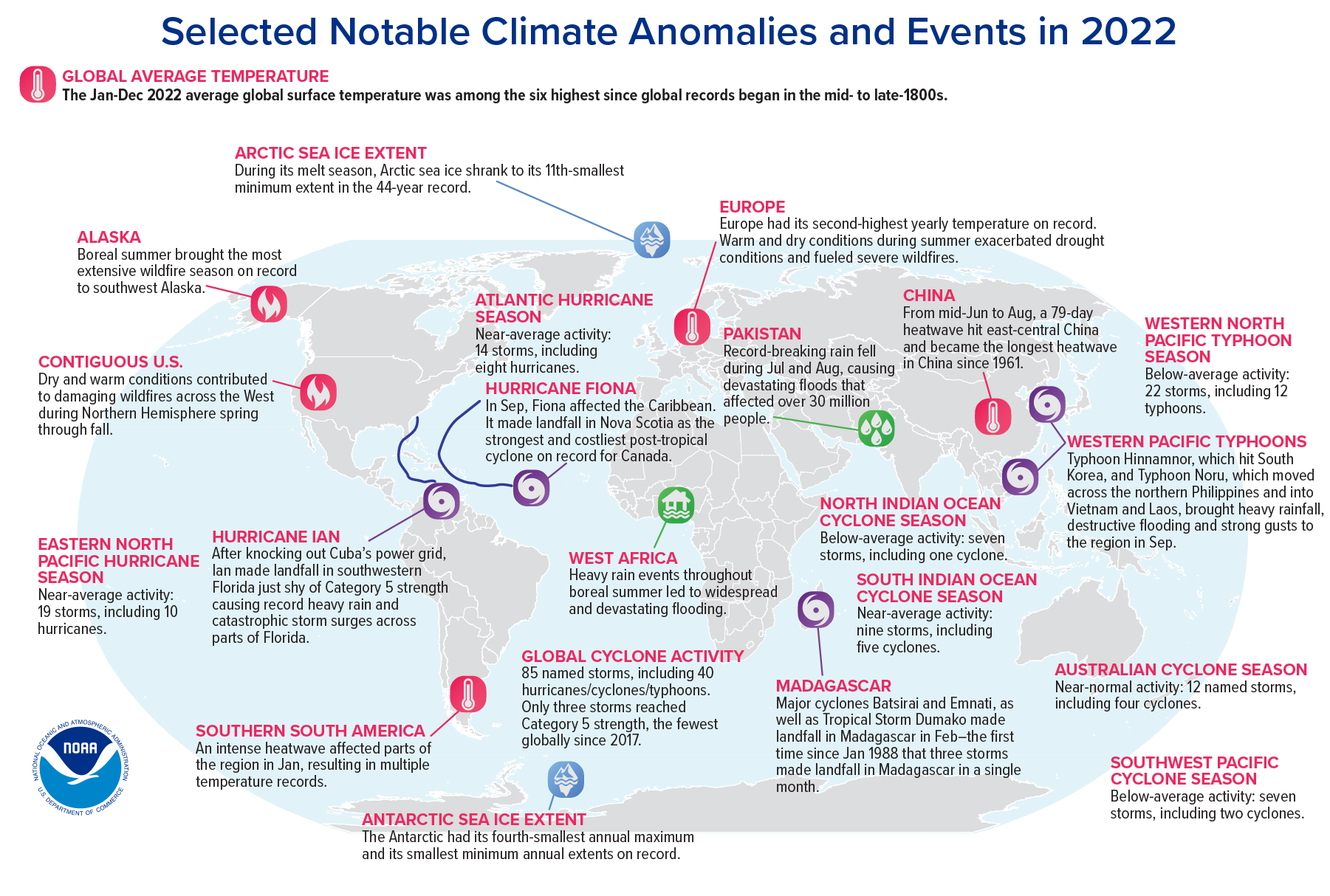
Map of significant global weather and climate anomalies and events of 2022.

Record-high greenhouse gases, sea levels, monsoons, and droughts—and a volcanic vapor injection

By Michael Alexander, Lead, Atmosphere Ocean Processes and Predictability (AOPP) Division, NOAA, and BAMS Special Editor for Climate

The annual NOAA/AMS State of the Climate report has just been released, with a comprehensive global look at the climate in 2022. Produced by the NOAA National Centers for Environmental Information (NCEI) and the American Meteorological Society, the State of the Climate Report maps out the complex, interconnected climate phenomena affecting all parts of the globe. It also charts global progress in observing and understanding our climate system. 570 scientists from 60 countries contributed to this year’s report, including a rigorous peer review, making it a truly global endeavor. 

As the senior editor on this project, I wanted to share with you a few highlights. Click here to read the full report, published as a supplement to the Bulletin of the American Meteorological Society.

New record-highs for atmospheric greenhouse gases CO2, methane, and nitrous oxide.

It was yet another record-setting year for atmospheric carbon dioxide and other greenhouse gases. 2022 saw an average concentration of 417.1 ± 0.1 ppm for atmospheric CO2; methane and nitrous oxide also reached record highs. 
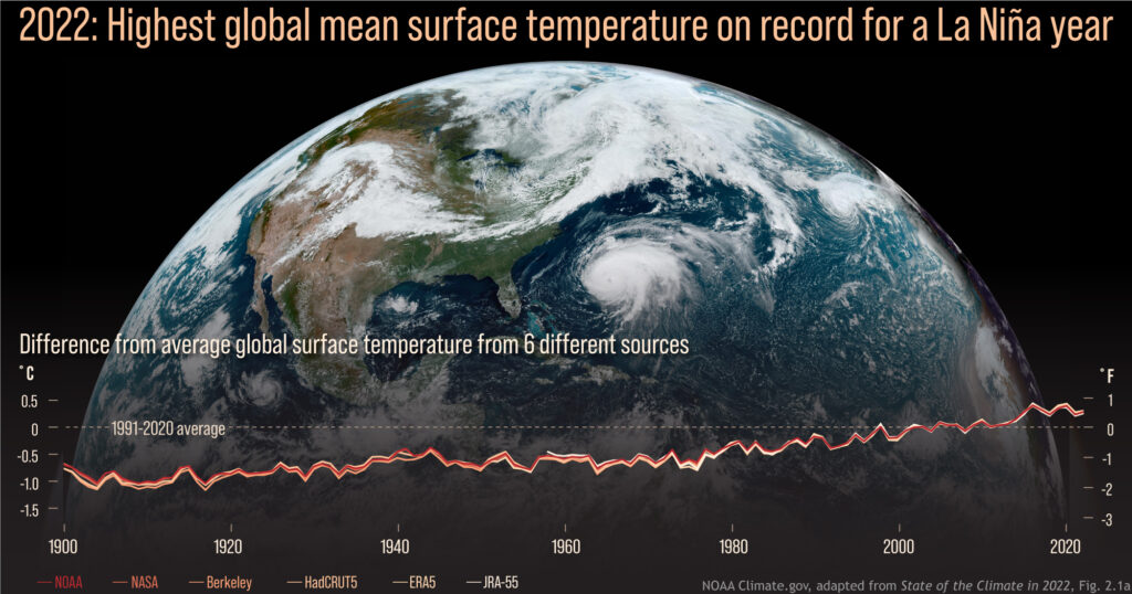
Graphs of yearly global surface temperature compared to the 1991-2020 average for each year from 1900 to 2022, from 6 data records, overlaid on a GOES-16 satellite image from September 22, 2022.  Image credit: NOAA Climate.gov.

Warmest La Niña year on record.

Despite being in the typically cooler La Niña phase of ENSO, 2022 was among the six warmest years on record, and was the warmest La Niña year ever recorded. Summer heat waves left annual temperatures at near-record highs in Europe, China, the Arctic, and Antarctica (parts of Europe set daily or seasonal heat records), and New Zealand experienced its warmest year ever. High-pressure “heat domes” helped elevate local temperatures in many areas, including parts of North America and Europe. 

Record-high global mean sea level and ocean heat.

Global mean sea level reached 101.2mm above 1993 levels, setting a new record for the 11th year in a row. 2022 also saw record-high global ocean heat content (as measured to 2000 meters below the surface), although La Niña moderated sea-surface temperatures.
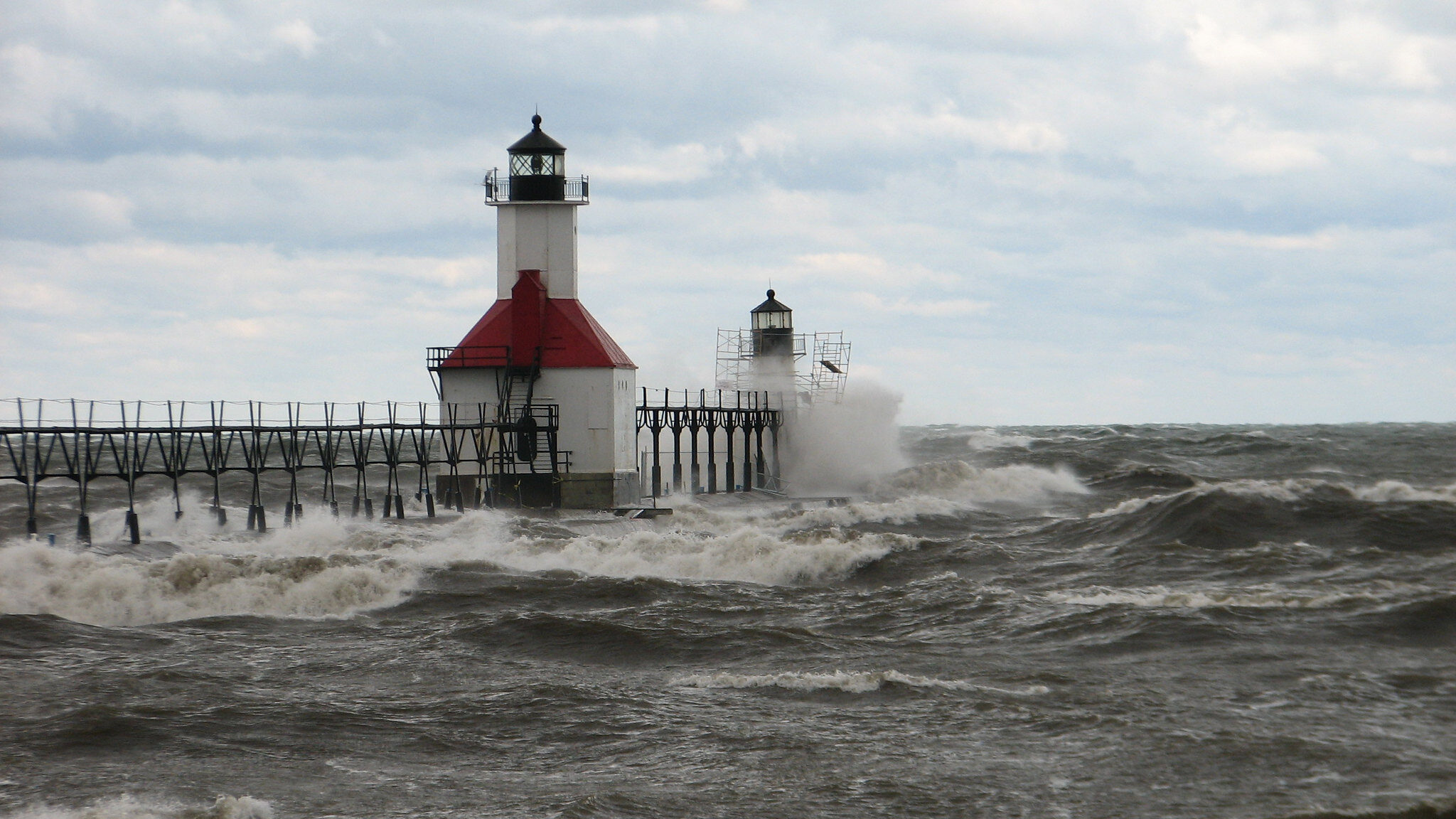
Image credit: NOAA

Complex climate picture.

Global warming trends continued apace, but of course numerous large-scale climate patterns complicated the picture. In 2022 we saw the first “triple-dip” La Niña event (third consecutive La Niña year) of the 21st century. The Indian Ocean Dipole had one of its strongest negative events since 1982, which led to increased temperatures and precipitation in the eastern Indian Ocean. Along with La Niña, this contributed to record-breaking monsoon rains in Pakistan that caused massive flooding and one of the world’s costliest natural disasters. We also had a positive-phase winter and summer North Atlantic Oscillation affecting weather in parts of the Northern Hemisphere. 

A bad year for drought.

For the first time ever, in August 2022, 6.2% of the global land surface experienced extreme drought in the same month, and 29% of global land experienced at least moderate drought. Record-breaking droughts continued in equatorial East Africa and central Chile. Meanwhile, parts of Europe experienced one of their worst droughts in history, and China’s Yangtze River reached record-low levels.

Warmth and high precipitation at the poles.

2022 was the firth-warmest year recorded for the Arctic, and precipitation was at its third-highest level since 1950. The trend toward loss of multi-year sea ice continued. Meanwhile, Antarctic weather stations recorded their second-warmest year ever, including a heatwave event that collapsed the Conger Ice Shelf, and two new all-time record lows in sea-ice extent and area set in February. On the other hand, record snow/icefall due to atmospheric rivers led to the continent’s highest recorded snow/ice accumulation since 1993.
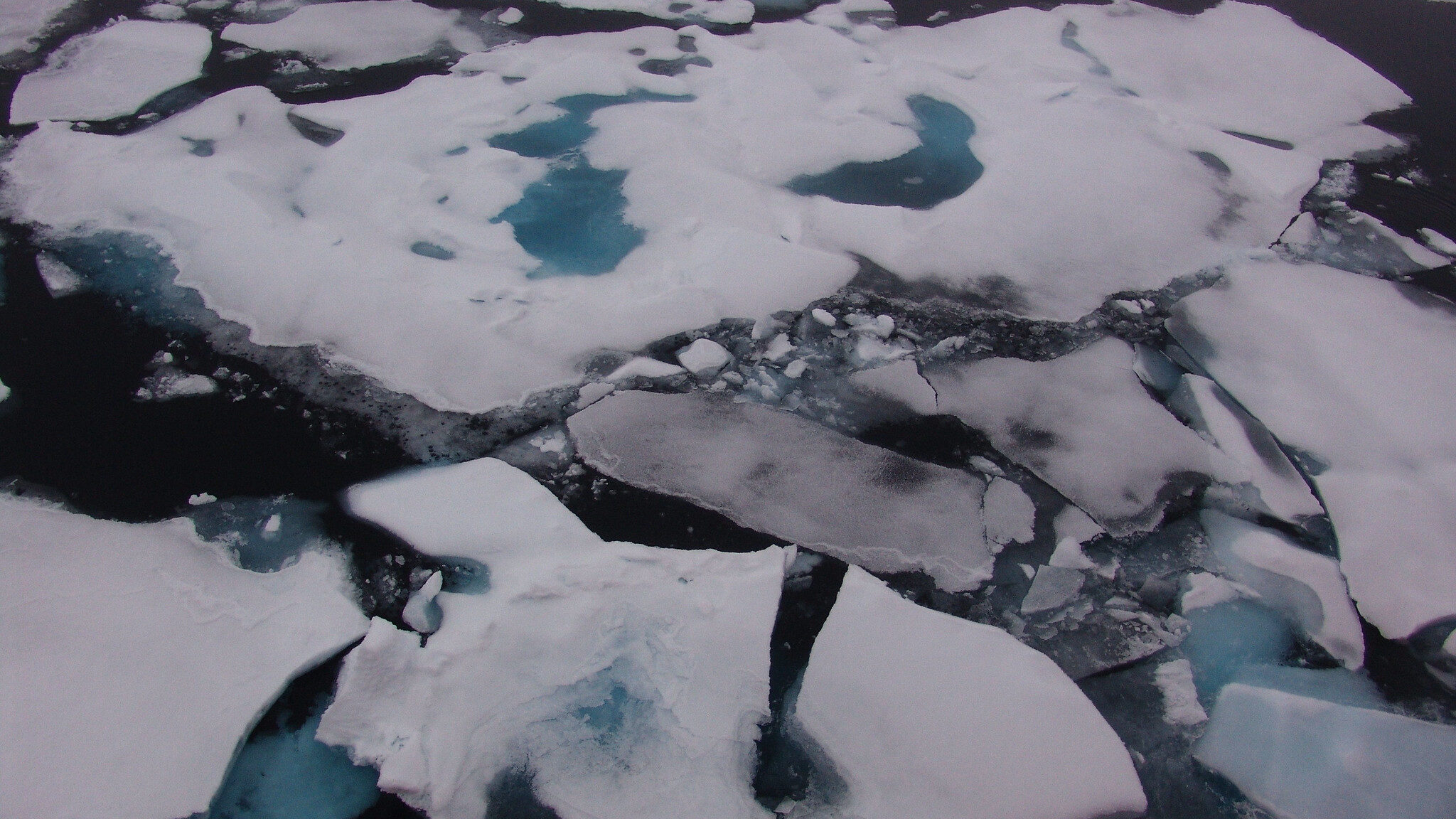
Image credit: NOAA

Notable storms: Ian and Fiona.

85 named tropical cyclones were observed across all ocean basins, an approximately average number. Although there were only three Category 5 storms, and the lowest recorded global accumulated cyclone energy, the year produced Hurricane Ian, the third-costliest disaster in U.S. history, as well as Hurricane Fiona, Atlantic Canada’s most destructive cyclone.

Massive volcanic injection of atmospheric water vapor.

The Hunga Tonga-Hunga Ha’apai submarine volcano in the South Pacific injected a water plume into the atmosphere of unprecedented magnitude (146+/-5 Terragrams, about 10% of the stratosphere’s total water) and height (reaching into the mesosphere). We don’t yet know what, if any, long-term effects this will have on the global climate, although the increase in water vapor has interfered with some earth system observations. 

The full report is a comprehensive and fascinating analysis of our climate system in the previous calendar year. I urge you to read it and communicate your own takeaways from the State of the Climate in 2022. You can read the press release here.

Infographic at top: World map showing locations of significant climate anomalies and events in 2022. Credit: NOAA.
Planning for the Next Superstorm: Kids Will Lead the Way

by Ellen Klicka, AMS Policy Program
Superstorm Sandy was a reminder that the best time for severe weather preparedness is before hazards strike. Unfortunately, it also made clear that many people still lack sufficient know-how to take measures against potential loss of life and property from natural hazards.
Where to get that know-how? From their kids!
At least, that’s the solution developed in a new online gaming initiative—the Young Meteorologist Program (YMP)—launched during the height of this week’s storm. Children can be passionate about issues that concern them and can be effective at mobilizing the whole family and ultimately the community. Thus YMP stands out from other preparedness initiatives by recognizing children as the gateway to educating families, neighbors, and friends.
YMP is an educational collaboration between the AMS Policy Program, PLAN!T NOW (a non-profit organization that assists communities at risk of disasters), the National Weather Service, and, eventually, children across the nation. PLAN!T NOW asked AMS to help create this free online resource and computer game about severe-weather science and safety. In 2010, AMS Policy Program staff connected PLAN!T NOW to disaster preparedness and response leaders.
NOAA contributed considerable knowledge and support for the Young Meteorologist Program and other PLAN!T NOW initiatives. The AMS Policy Program and NOAA advised PLAN!T NOW on such topics as storm classification, tornado development, flooding and storm surges. The National Education Association also assisted to ensure the educational quality of the program. The diverse team of experts involved in YMP includes educators, scientists, entertainers and software developers, all working towards the common goal of creating disaster resilient communities across America.
The joint effort culminated in YMP’s public launch on October 29, as the Eastern seaboard began to feel Sandy’s impact. The AMS Education Program has assisted in promoting the program’s availability by reaching out to its network of K-12 science teachers. YMP will be a part of classrooms, museums, libraries, major city expos and events all over the country, reaching tens of thousands of children and adults.
YMP also brings Owlie Skywarn – a trademarked character of NOAA, revised and updated by PLAN!T NOW – into the 21st century by making him a central character in an interactive environment online—no longer limited to printed brochures. YMP game designers began with educational material from a NOAA booklet featuring Owlie; he and a host of other animated characters help each child become a junior data collector for the game’s “Weather Center.” Game modules cover hurricanes, lightning, floods, tornadoes, and winter storms. Each game is created in full, interactive animation.
Students who complete the online program earn a Young Meteorologist Certificate. Empowered by this recognition of their knowledge and effort, they are more likely to encourage parents and others to make assemble disaster kits, write emergency plans, and overall make preparedness a priority. The kids are invited to put their new knowledge to work through hands-on activities and community service projects highlighted on the program’s website. Resources for educators, parents and meteorologists to give further guidance to the Young Meteorologists are also available there.
Attendees at the upcoming AMS Annual Meeting in Austin, Texas, can learn more about YMP from the expert’s perspective–NOAA’s Ron Gird and colleagues will present a poster at the Education Symposium (2:30-4 p.m.; 7 January 2013). Dan Pisut of NOAA’s Visualization Lab spoke to the AMS Broadcast Conference about YMP this past August, and that presentation can be heard on our meetings archive.
Future versions of YMP may include new modules on fires and tsunamis, in addition to the five modules in the current game. Other scientific disciplines, such as oceanography and climatology could serve as the basis for programs similar to YMP down the road.
Prepared communities start with prepared households. AMS and its partners are recognizing that those households might become prepared because of knowledgeable children.

New Warnings, New Words

National Weather Service offices in Missouri and Kansas recently initiated an experiment testing new tornado warnings that combine more specific information with more descriptive language than have been used in the past to describe the potential effects of storms. The experiment is called “Impact Based Warning,” and is meant to bluntly tell residents in the path of tornadoes what could result if they don’t seek shelter. By using phrases such as “complete destruction” and “unsurvivable if shelter not sought below ground,” the NWS is hoping to “better convey the threat and elevate the warning over a more typical warning,” according to Dan Hawblitzel of the Pleasant Hill, Missouri NWS office.
The new alerts got their first big test last weekend when more than 100 twisters were reported in Kansas, Oklahoma, Nebraska, and Iowa. While the NWS’s Storm Prediction Center issued a warning of possible life-threatening storms in several midwestern states days before they touched down, in Kansas the words used in the new alerts were particularly trenchant: “You could be killed if not underground or in a tornado shelter. Many well-built homes and businesses will be completely swept from their foundations.” And the warnings seem to have worked. Despite the large number of storms, only six people were killed—all in an overnight tornado that hit Woodward, Oklahoma. In Wichita, Kansas, a twister tore through a mobile-home park during nighttime hours, but there were no fatalities.
The Impact Based Warning experiment was developed by the NWS in consultation with social scientists. Along with the new vernacular, it includes some key additions to regular tornado warnings, including information that identifies the hazard (hail, winds, tornado, etc.), indicates whether the hazard has been spotted by radar or by people on the ground, and describes potential effects of the hazard (loss of life, damage to trees or buildings, etc.). The warnings can be used not only for tornadoes, but also to signify life- or property-threatening thunderstorms. The experiment is scheduled to run through the end of November, at which point it will be evaluated and considered for more widespread use.
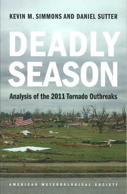
The initiative comes  just one year after tornadoes killed more than 500 people in the United States—the deadliest season in almost 60 years. The 2011 year in tornadoes is examined in the new AMS book, Deadly Season: Analysis of the 2011 Tornado Outbreaks, by Kevin M. Simmons and Daniel Sutter. The book is a follow-up to the authors’ Economic and Societal Impacts of Tornadoes, published by AMS in 2011. The new title looks at possible factors contributing to the outcomes of 2011 tornado outbreaks, including assessments of Doppler radar, storm warning systems. and early recovery efforts. Both books can be purchased here.

Suomi Now Smiles Down Upon Us

NASA and NOAA announced today at the AMS Annual Meeting in New Orleans that they have renamed the recently launched polar orbiter, NPOESS preparatory project, the Suomi NPP, after the late Verner Suomi, who was one of the pioneers in creating instruments for satellite observations of the weather. AMS annually gives out a prestigious Verner Suomi Award for technological achievement–this year’s winner is Anne Thompson.
“Verner Suomi’s many scientific and engineering contributions were fundamental to our current ability to learn about Earth’s weather and climate from space,” says John Grunsfeld, associate administrator of NASA’s Science Mission Directorate. “Suomi NPP not only will extend more than four decades of NASA satellite observations of our planet, it also will usher in a new era of climate-change discovery and weather forecasting.”
Suomi, who died in 1995 at the age of 79, spent nearly his entire career at Univ. of Wisconsin. He is legendary for developing the spin-scan camera, which allowed satellites in stationary orbit of one point on Earth to maintain continuous focus and enable, among other capabilities, the instant-replay-style weather images we watch on television.
In 1968 he won the AMS’s highest award, the Rossby Medal

for his imagination, ingenuity, and versatility in conceiving and designing diverse meteorological sensors which have helped to transform the satellite as a meteorological probe from a dream to a reality. His Spin-Scan camera has given us our most comprehensive views of the atmosphere as an entity, and has already led to revised ideas concerning the circulation in lower latitudes.

and in 1977, he received the National Medal of Science — one of many awards — though his son Eric Suomi expects his father would have been particularly appreciative of Suomi NPP’s mission and new name.
The University of Wisconsin gathered comments on the name change:

“I think this is an excellent match,” says Eric Suomi, an electrical engineer who lives in Madison. “Had my father still been around, he would have been pushing for more of the kind of instruments on this satellite and the observations they’ll be making of our planet.”
“Vern flew the first experiment to look at the Earth from space on Explorer 7,” says Hank Revercomb, a Suomi collaborator and director of UW-Madison’sSpace Science and Engineering Center, which Suomi helped establish in 1965. “That was a radiation budget experiment, and there is actually a similar experiment, an instrument called ‘CERES,’ on the spacecraft they’ve named for him.”
Suomi NPP will also add to long-term climate records, monitor the health of the ozone layer, measure global ice cover and air pollution levels, map vegetation and — with the help of a sounder, an instrument conceived by Suomi and refined by Revercomb — contribute to better weather forecasts with sharper data on cloud cover, wind, temperature and atmospheric moisture.
“This satellite is designed to study the atmosphere and improve our understanding of how and why changes make a difference in our weather and climate,” Univ of Wisconsin Professor Steve Ackerman says. “Those were Day One objectives of Verner’s from the 1950s.”


You've Got a Flare for Science

Last night while you were out partying on Bourbon Street, the Sun was at work. According to NOAA, our home star produced an R2 (Moderate) radio blackout x-ray burst–call it a flare–accompanied by potentially the fastest Earth-directed Coronal Mass Ejection (CME) of the current solar cycle.
The flare was observed at 11 p.m. EST and radiation reached us an hour later. As of 6 a.m. local New Orleans time, radiation was already considered “strong” (S3). Initial model guidance showed the CME arriving around 9:00 am EST on Tuesday. NOAA space weather forecasters say this will cause the strongest solar radiation storm since December 2006, with potential for electrical grid disruption.
What impacts should you expect? (Hopefully, no more wireless outages in the Convention Center here in New Orleans!)
Seriously though, the best thing to do for your edification is to get over to the Space Weather Symposium this afternoon at the AMS Annual Meeting. Today’s session (4 p.m.-5:45 p.m., Room 252/3 include talks on impacts of space weather on aviation, networking, navigation, electricity transmission and more. And given our focus on futurism, consider this space weather question raised by presenter Karen Shelton-Mur (of the FAA):

Once low-Earth orbit (LEO) capabilities are demonstrated by commercial companies, it is anticipated that LEO flights will be expanded to include space flight participants (private citizens). The expansion of commercial space activities into LEO will expose more humans to the harsh space environment than ever before. Without proper authority and monitoring of on-orbit activities, how will the FAA ensure safety of the crew, its space flight participants, and safety critical systems on board the spacecraft?

No question, this stuff is “out there” and cool and very sophisticated application of the forward edges of atmospheric science. Today’s solar flare is a reminder that the way we use technology is pushing this community in new directions all the time.

Where Do We Feel at Home Now?

You can’t go home again, novelist Thomas Wolfe famously explained in a novel published, ironically, in 1940–the year Franklin Delano Roosevelt moved the U.S. Weather Bureau from the Department of Agriculture to the Department of Commerce.
President Obama’s intention to move the National Oceanographic and Atmospheric Administration to the Department of Interior raises all sorts of questions, political, economic, and scientific. It will be impossible to avoid these questions as we gather in New Orleans.
But some people already frame the question as a matter of philosophical, social, and stylistic fit–of how a scientific entity makes a home in a bureaucracy generally obsessed with the back and forth of entitlement and regulation. Environmentalists, for example, have been quick to wonder how scientific management of ocean fishing fares when paired with the agency permitting offshore oil drilling.
As reported in Science online, Scott Rayder, former NOAA chief of staff and now with ITT Exelis Geospatial Systems, noted numerous correspondences between the portfolios of NOAA and its Interior counterparts, yet added, “But one concern is how would these cultures fit together? They have different ways of doing business.”
Finding the right culture for weather services has been an age old problem. AMS Policy Director Bill Hooke goes into detail on the long history of migrations within the federal government from Surgeon General, to Smithsonian, to Army Signal Service, to Agriculture, to Commerce, concluding that there’s an evolving conflict between the ever intensifying, diversifying need for a NOAA-like agency that integrates science and service and a continual political desire to place the agency where it might seem most at home.
A community that serves the development of an economy, sustainability of the environment, and basic security of citizens facing severe weather every day and climate change in the long run is never really going to have just one natural fit in a political scheme. Everyone needs a piece of NOAA. So ultimately the job needs to be done, single-mindedly, and at the same time NOAA is always going to engage nearly every nook and cranny of national welfare. As Hooke points out that the place of this key piece of our community within the federal firmament probably matters less than we might think:

The Earth itself didn’t reorganize. It’s still working the same way, proving to be resolutely variable locally, and globally, and on all time horizons. The proposed government reorganization doesn’t add to or subtract from our imperfect understanding of that Earth. The little bit we know, we still know. The part that remains undiscovered is still opaque. The mechanics of translating knowledge into social benefit remain absorbing. Our little piece? It still needs doing. The urgency and importance of our work continues to grow.

These facts give hope but they don’t solve the cultural question: a mission that grows will never be completely at ease anywhere for long. What is true for people has proven true for a scientific community. As your own experiences change you, home becomes elusive. So the peripatetic governmental entity that has been at the core of our community does not clearly belong anywhere because, well, the notion of weather service has evolved as well. We don’t even call it that, anymore–we talk about national hydrometeorological services, climate services, space weather, sustainability, public health, and so much more.
What is our culture, and how much has it changed? The study of culture is the province of anthropologists for a reason: they are trained to cultivate an outsider’s perspective. De Toqueville’s observations as a Frenchman in America are all the more trenchant for the same reason that Margaret Mead’s observations of Samoans give us insight into our own behavior. All the more valuable, then, are the observations of a onetime-outsider, George Siscoe, a solar physicist and member of one of our most recently developed branches, space weather. Amidst ten historical stages of fundamental change in our community, Siscoe noted a continuity as well:

The orientation of the terrestrial meteorological community, including its research community, is by and large in
the direction of improving forecasts. Most researchers in meteorology might not consciously recognize this, but
program managers and agency heads apparently do, as evidenced by research programs that they define and
support. Moreover, it imbues research meteorology as a community trait, like a shared language. Meteorologists
acquire the trait from their undergraduate and graduate courses and from the example of professional icons such
as Carl-Gustaf Rossby, Jacob Bjerknes, John von Neumann, Edward Lorenz, and Jule Charney. The result is
coherent, discipline-wide progress, discernable against the separate advances of intradiscipline specialties, that
moves the full front of operational forecasting forward. Orientation toward improved forecasts, be it of storms,
global warming, or the ozone hole, constitutes a binding and supportive matrix within which the whole
discipline is consciously or unconsciously embedded.

The weather community can’t go back to being a mystery for medicine men, a toy of pure researchers, an exercise of military regimen, or a sleepy backwater for farmers, nor, for that matter, the business that is the nation’s business. Somehow, in the course of its growth, it is all of these and more: something recognizable but clearly different. What has become–or what it is to become–will probably hinge on this relentless drive for operational improvement. That culture will determine where home really is now, regardless of where the government puts it.

Have You Modernized Today?

Have you swapped out some old incandescent light bulbs for the newfangled LED lights lately? How about upgraded some software? Switched to online billing?
If you don’t keep up, light bulb by light bulb, technology can leave you behind.
How far behind? According to the National Research Council’s draft report, “National Weather Service Modernization and Restructuring: A Retrospective Assessment,” very far, necessitating an infusion of $4.5 billion from 1989-2000 involving not just new radars, supercomputers, models, data distribution and integration systems, and satellites, but also wholesale movement of offices, shifting of responsibilities. They conclude,

If a science-based agency like the National Weather Service, which provides critical services to the Nation, waits until it is close to becoming obsolete, it will require a complex and very costly program to modernize.

Lesson learned. The new report, which will be the subject of a Town Hall Meeting in New Orleans (Tuesday, 24 January, 6-7 p.m.), issues many compliments to the NWS for the effect of a well planned modernization:

  • more uniform radar coverage and surface observations across the United States and resulting improvements in handling severe weather.
  • greatly improved communication and dissemination of weather information
  • more evenly-distributed, uniform weather services to the nation.
  • strengthened relationships with community partners, leveraging benefits of modernization.

The report contains much wisdom about how to upgrade and stay on top of the waves of innovation that continually stretch–and thrill–people who work in this field. It notes the need for keeping good statistics of performance to help argue for, and evaluate, modernization. A common theme of recommendations is also the need for better systems engineering–having the expertise, and using early and continually throughout the modernization process is essential. The report also doesn’t neglect the human factor: scientific organizations need dedicated leaders who can see through the modernization process, and as a whole NWS has benefitted now that it has a culture, and a framework, of continual modernization.
There are also pitfalls to expect: the reduced agency workforce was balanced by increased technological costs–agency cost savings were minimal at best. external oversight ensured valuable accountability. Budget overruns and delays were common, some stemming from lack of initial analysis.
While you’re mulling over how this might help you stay up on your career and upgrade your household and office–call it personal modernization, the recommendations of the report are an undercurrent of many sessions at the AMS Annual Meeting, where so much attention is paid to technology. A number of presentations are focusing, for instance, on the AWIPS II and Dual-Pol Radar upgrades in the NWS. But also, for example, Marie-Francoise Voldrat-Martinez is presenting on what various upgrades to WMO and European hydromet and geospatial distribution systems will mean for MeteoFrance’s own information systems modernization (Monday, 1:30 p.m., Room 356).
You can be sure the developing world is listening. Vladimir Tsirkunov, of The World Bank, will be presenting Monday (11:45 a.m., Room 333) on the growing need for better hydrometeorological services internationally. The World Bank is putting money into modernization of national hydrometeorological services. He warns that “capacity in many regions is not adequate and degraded in some countries during the last 15-20 years.”
Sounds familiar. On a less extreme level, there was a time, before 1989, before those $4.5 billion, before a whole new culture, and a whole bunch of new equipment and systems, when people were worrying about similar issues in the United States. No jokes, please, about how many meteorologists and dollars it takes to screw in a new lightbulb!

iPhone Game Puts Satellite Data in Your Hands

The Los Angeles Times compares it to Tetris and calls it “the nerdiest game ever“. As far as we’re concerned, that’s a sure-fire journalistic badge of honor for Satellite Insight, the new iPhone game app from NASA and NOAA.
The object of the new game is to control real-time Earth and space weather data. Colored blocks falling into columns on a grid represent small pieces of data. To save lives and protect expensive instruments, the GOES-R weather satellite must not lose any data. Players bundle like data types together before the grid overflows. Data blocks fall slowly at first, but arrive faster as the game continues. Each speed-up also brings a power-up tool you can use at any time to help clear the grid. Keep it going as long as you can and try to beat your best time. Explains NASA’s web site:

No matter how thirsty you are, it’s not easy to drink from a fire hose. But that’s similar to the challenge of capturing and storing the huge blast of images and information that the new GOES-R weather satellite will gather.

And of course, as a NASA and NOAA product, the game has an educational mission too–the instructions include information about the upcoming real-life GOES-R satellite.
Satellite Insight is available free for iPhone and other iOS devices on iTunes. Check it out here.
 

Jack Townsend, Shepherd of Weather Satellite Technology

The passing of AMS Fellow John W. (“Jack”) Townsend on October 29 serves as a fitting moment to register the evolving national relationship with space technology over six decades.

“Jack Townsend was truly one of the seminal figures in the history of NASA, and certainly, in the history of Goddard,” said current Goddard Spaceflight Institute Director Rob Strain. “The story of the space program simply could not be written without a chapter devoted to him. He dedicated his life to the exploration of space and the study of our planet, and humankind is richer for the knowledge he helped generate.”

Townsend was one of the first employees at Goddard in 1959, where he directed the satellite applications efforts, at a time when the nation was racing to enter the Space Age. He had already cut his teeth on space technology, first in radar countermeasures aboard B-29 bombers in World War II and, by 1949, working with V-2 rockets. Townsend helped bring satellite meteorology to fruition in the 1960s as Deputy Administrator of the Environmental Science Services Administrator (predecessor to today’s NOAA). After a decade at Fairchild Industries, he returned to NASA after the Challenger disaster, and then for three years as Director of Goddard.

Townsend retold the story of the origins of weather satellites just a year ago in an interview with archivist/historian Doria Grimes:

[E]verything started with sounding rockets just after World War II. I went to work for the Naval Research Laboratory (NRL) following my graduate degree in physics. The sounding rocket program had just started at NRL and it involved the Army, Navy, and Air Force…. Interestingly enough, at White Sands, New Mexico, we flew rockets out over the desert in the late 1940’s. We put cameras on them called gun sight aiming point cameras, “GSAPs”. The idea of the camera was that as the rocket went up and rotated, it took pictures of the earth in swaths. You would use those pictures to reconstruct the attitude of the rocket.

One day we had a shot in New Mexico in which we caught what looked like a storm in pictures off to the southeast. One of the guys who worked for me, Otto Berg, made a composite picture of nearly 1,000 tiny GSAP pictures, a total mosaic of a storm. It looked exactly like a hurricane, and attracted the Weather Bureau’s attention. It was in the early 50’s – all before Sputnik.

The pictures stirred interest from Harry Wexler at the Weather Bureau, and eventually a classified Army satellite project was moved into the new NASA, gradually became declassified, leading to the first weather satellite, TIROS. It was during this period that Townsend and other American science administrators were involved with negotiating peaceful uses of space technology with their Soviet counterparts.

The subject came up of transferring data. We, at that time, expected to launch the research meteorological satellites. They promised they were going to launch meteorological rockets and satellites. Incidentally, they never did. But they wanted the transferred data because Russian ground data was very sparse, and these data meant a lot to them as a country. With the free transfer of meteorological data and satellite pictures, we had an issue, a big issue. Who pays for the communication expenses between Washington and Moscow? We got into a big fight about that, and the agreement had been to share. The Russians said that since the U.S. owns all these communications facilities, the U.S. should pay for 90% of it. Then the Russians said that the ruble was not worth as much money as the dollar. Finally, I came up with one of the only brilliant ideas I ever came up with. I said sharing means 50/50. We’ll pay the bill for three months, and you pay it for three months….So I cut this deal with the Russians on how to pay for it. [His Russian negotiating counterpart] Blagonravov thought it was funny. He laughed, and said to me, “I am glad I am too old to send to Siberia.” He was a lieutenant general which is a five star rank in those days, and he also was a communist and believed in the system. He was a neat guy and I got to like him.

The whole interview (transcript here) has more on the origins of the space program, NOAA, and operationsl satellites. You’ll get the sense that the field was guided then by strong personalities and a country committed to technology. [For more on the early development of weather satellites, specifically TIROS, check out James Rodger Fleming’s presentation on “Transformative Technologies and International Cooperation in the Career of Harry Wexler” at the 2012 AMS Annual Meeting (11 a.m., Tuesday 24 January)].

A Pastime That Can't Be Postponed Due to Weather

by William Hooke, Director, AMS Policy Program. Excerpted from a post on the AMS project, Living on the Real World.
Google the expression “Weather-Ready Nation” and you’ll see a rich set of offerings. That’s because the National Weather Service is using this label to describe a comprehensive initiative to make America safer in the face of weather hazards. Recall that America has what is arguably the most hazardous weather on the planet – as many winter storms as Canada, China, or Russia; as many hurricanes as southeast Asia, Japan, etc.; and a virtual lock on the world’s store of tornadoes. Nine separate weather disasters each totaling over a billion dollars in losses this year alone. So a Weather-Ready Nation? No trivial ambition.
But weather doesn’t have to be severe to be high-stakes.
The latest example? Yesterday’s decision by Major League Baseball to postpone the sixth (and possibly deciding) game of the World Series, originally scheduled for last night in St. Louis, until tonight.
Baseball games – even World Series games – have been called on account of rain before. What makes last night’s call unusual was that it was made several hours before game time, while the field was still dry – based on a forecast, rather than an unplayable fieldper se.
The sports press has been full of this story. Want a sample? You can find St. Louis coverage here and national coverage here. Discussion of the possible consequences, and the range of implications, has been extensive. Here’s a sample.
Some saw the decision to postpone this way: as diverting a potential disaster for Fox, the network carrying the game. A rain delay, and a game which might possibly decide the Series (the Texas Rangers are ahead of the Cardinals 3-2 in games) being concluded late, with trophies awarded only in the wee hours of the morning, after viewers had gone to bed, would not be Fox’s preferred outcome. Others noted that the one day delay expands the pitching options available to both managers; their starters have all gotten an additional day’s rest. Cardinals have had one more day to brood about the mis-communication between dugout and bullpen that hurt their chances in Game 5. The Texas Rangers, undoubtedly eager to wrap things up, have had to pace their hotel rooms an extra day.
It’ll be difficult to assess the impact of the decision; the World Series is not part of a controlled experiment. [We didn’t get to clone the teams and explore alternative universes, one in which they tried to play the game last night, and another when they played this evening.] But this Series has been so close that a one-day delay may well be seen to matter in hindsight.
And the funds at stake are substantial. The difference to individual players on the winning and losing teams amounts to something like $100,000 apiece. Team revenues for the Series also vary. But the real stakes become apparent the following year. The winners can look forward to increased season ticket sales, higher advertising revenues, a larger fan base and other economic plus-ups.
What’s striking in all this press coverage? No negativity about the NWS role. In fact, here’s a quote attributed to MLB executive vice president Joe Torre:  “It really wasn’t difficult because every single weather report that we’ve had for about three days has predicted rain during the game,” he said on MLB Network, adding that a good forecast for the next two days helped influence the move. “If we’re not right (with the early postponement), we wanted to make sure we were doing it on the safety side,” he said. “That’s why we called it so early.”
This takes us back to all that discussion over the summer about the importance of NOAA’s polar orbiting satellites to the day-to-day consistency in forecasts of approaching weather for decision-making. [You can find material from this blog here.] Note that baseball executives made the call based not just on the forecast for last night’s weather, but the outlook for St. Louis tonight and tomorrow night, in case a Game 7 is required.
This particular forecast was relatively visible nationally, but the fact is that our country uses National Weather Service forecasts to place multi-million-dollar bets every day. The smart money doesn’t wait for the weather to change. They’re acting on the forecasts of that change. Utilities forecast energy demand, not just for the country as a whole but region by region and metropolis by metropolis. Airlines are cancelling and rerouting flights based on weather predictions. Water resource managers are looking ahead to demands and stresses on their watersheds. Agribusiness is constantly adjusting its decisions on when, what and where to plant, the application of pesticides, herbicides, and fertilizers, and how to hedge against sudden changes in international market supply and demand. The lists and the stakes are growing. The Nation grows more weather-ready by the day.
Play ball!