Yes, We've Got Maps


This point was made at Monday’s Presidential Forum, where Dr. Richard Jackson of UCLA was talking about how much our scientific community offers to the world of public health, and how we might best be able to move decision makers to action based on climatic information.
It is good news. Nobody makes maps more eagerly than meteorologists.
Hardly a session goes by at the AMS Annual Meeting without some sort of map—often of some unexpected variable. For example, today at 10:45 a.m. (Skagit 4), Yonghua Wu (City Univ. of New York) and colleagues pull together trajectory modeling, lidar ceilometer, and satellite observations to map air quality variations due to the interaction of boundary layer conditions with wildfire smoke plumes this past summer over New York City.
blog_logo_final_all_caps_updateThen on Thursday (1:45 PM, Tahoma 2), you can map the New York City area again, in a completely new way: Sina Kashuk of NOAA shows spatial density maps of the 5 million flood-related phone calls across the five boroughs.
Using the top 25 most frequent complaint types ranging from noise to rats, the overall propensity of calling was estimated and mapped. This map was then used to normalize the flood-related complaints. The temporal-spatial analysis was highly correlated with monthly rainfall intensities.
Clearly, no place is mapped in one particular way. Maps say as much about the data and the analysis as about the specific location. Mapping is thus an essential tool for coalescing, analyzing, contemplating, and communicating observations.
Harvard historian Peter Galison takes this point a step further in his studies of the history of observing as evinced by map-making. Through a selection of atlases across the centuries, all made by scientists, he shows how the powers of observation and the expectations and capabilities of science are all intertwined, and all evolving. The idea of observing itself is not the same today, he shows, as it was in Newton’s time or even in Einstein’s. In this lecture from 2011 he uses the atlases to trace the history of objectivity itself in mapping:

 
Which brings us warily to the title of a presentation this morning (8:30 AM, Room 611) , “Beyond Maps-How Cloud Computing Enables the Future of Geospatial Analysis Services.” Presenter Steve Kopp of ESRI explains:

[W]e now see a technology transformation that is enabling deeper understanding, and will lead to new insights and new discoveries. Early adoption of geospatial cloud computing focused on organizing and sharing data….Map services (a picture of the data) are symbolized data ready to view, and require fewer specialized skills than working with raw data such as GRIB files. More recently organizations have begun providing weather and climate data services. These are feature services like WFS and image services like WCS. Data services allow customization of the symbology and more flexibility in visually combining with other data, but also can be used for analysis allowing the user to ask new questions with the data. The transition to data services feeding into analysis services will have a profound impact on the utility and growth of geospatial cloud computing.

Perhaps someday historians will see this AMS Annual Meeting as a part of shift that led the way to yet another stage in the growth of science itself.
The Future Starts Now with Student Conference

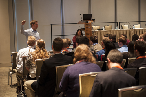
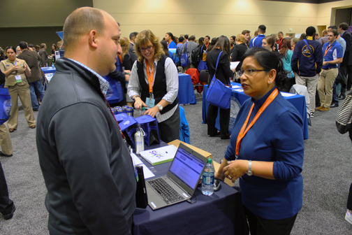
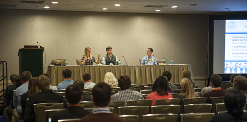
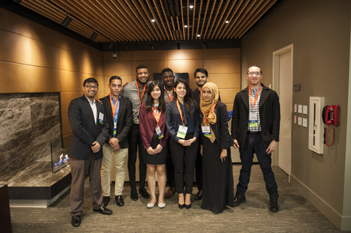
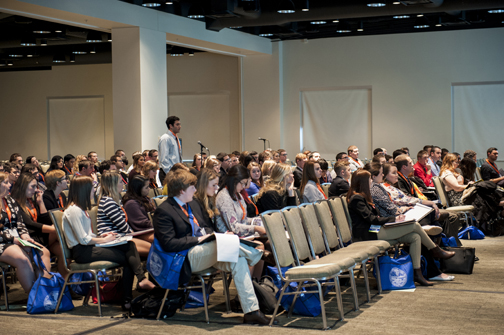
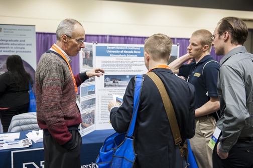
The Annual Meeting kicked off this weekend with one of our biggest Student Conferences ever, as more than 700 students were in attendance. It was a lively, entertaining, and educational event for everyone who participated, as can be seen in these observations taken at the Conference:
student_conf1
student_conf_career_blog
student_conf2
student_conf_career_blog2
Student_conf_final
studen_conf3
 

Time to Lengthen the Official Hurricane Season?

Last week, the fourth named storm—Danielle—of the Atlantic hurricane season formed. It was the earliest such formation in any of the 165 seasons on record. Tropical Storm Colin preceded Danielle just days into the official season, which runs from June 1 through November 30, and was the earliest-on-record third named storm. And Tropical Storm Bonnie formed in May, prior to the season’s start, a pattern that seems to have increased in the past decade.
It makes one wonder: should the official Atlantic hurricane season be lengthened to accommodate the earlier storm formation? The season for Eastern Pacific tropical storms and hurricanes, which form off Mexico’s coast, already does. It runs from May 15 to Nov. 30, and almost like clockwork, the first storm of that season will typically appear midmonth or after.

In the past decade, half of the Atlantic’s seasons had “preseason” storms. In 2012, two storms—Alberto and Beryl—were named before the season officially started. And last year, Ana formed east of Georgia on May 7. Granted, it was initially a subtropical storm, a hybrid with both tropical features and features of midlatitude cyclones. But waters were warm and Ana became fully tropical in just days, and moved ashore in South Carolina on May 10.

In an e-mail exchange with James Franklin, branch chief of the Hurricane Specialist Unit of forecasters at the National Hurricane Center, he noted that the current 6-month Atlantic hurricane season was established in 1965 and was based on the formation dates of roughly 97% of the total annual tropical cyclone activity in the Atlantic basin, which includes the northern hemisphere Atlantic Ocean, Caribbean Sea, and Gulf of Mexico.

Franklin pointed out that tropical cyclones have formed in every month of the year, including Hurricane Alex this year in January. (Its formation was considered a very late entry in the 2015 hurricane season, despite its “A”-name designation in the calendar 2016 season.) He also pointed out that moving the season up to May 15 wouldn’t have prevented an out-of-season start in half of the recent early-season years (in addition to Alex and 2015’s Ana, 2007’s Andrea formed on May 9).

While extending the season might not catch all early storms, it would accommodate an increasing number. Weather Underground’s Jeff Masters and Bob Henson blogged last year with Ana’s early development that it isn’t all that rare to have early-season storms. Adjusting the numbers up by two for 2016, they conclude that 41 preseason tropical or subtropical systems have formed in 33 separate years since record-keeping began in 1851. Since the satellite era began in 1960, which improved detection of tropical systems basin wide, they find that there has been on average about one such system in the Atlantic every 2-3 years.

“Preseason named storms may be getting more common,” they wrote. Of note, they mentioned a 2008 paper published in Geophysical Research Letters by Jim Kossin of the University of Wisconsin, titled “Is the North Atlantic hurricane season getting longer?” that supports an earlier start to hurricane season. Kossin concluded that there is an “apparent tendency toward more common early- and late-season storms that correlates with warming sea surface temperature, but the uncertainty in these relationships is high.”
So the question remains: Is it climate change that necessitates a longer season, or natural variability?

Franklin states that there would need to be pretty convincing evidence “to go to the trouble of changing the official season. I don’t think we know whether this ‘uptick’ is real or apparent, or whether it will persist,” he writes. “I think we’d want to see a definitive trend in the long-term climatology before contemplating such a change.”

Makes sense. However, if we have too many seasons like these past several years, with multiple storms in May, starting hurricane season on June 1 may begin to appear arbitrary.

What do you think?

Rare, Early Season Hurricane Party in the Tropics

You’ve likely heard the rumors that wherever the AMS Annual Meeting takes place, unusual and sometimes awful weather befalls that particular city. San Antonio, Texas, for example: AMS Annual has been there twice—in 1982 and 2007—and both times ice storms besieged the city, much to the dismay of residents and especially the city’s politicians. There’s nothing other than coincidence to this, of course; a convergence of meteorologists can no sooner conjure up furious tempests than AGU meeting attendees can deliver a mega disaster of geophysical proportions to their host city.
But … as the 2016 AMS Annual Meeting draws to a close, the tropical record books are coincidentally being rewritten: Hurricane Pali had been whipping the Central Pacific near Hawaii for much of the week, and, now, another hurricane—named Alex— has formed in the Atlantic Ocean. In January! And a hurricane warning has been issued for the Azores Islands. Did we mention … it’s January!!
It’s unprecedented: simultaneous tropical cyclones in the Atlantic and Pacific Oceans in the first month of the year. The average date of the first Atlantic named storm is July 9th. The first named storm in the Central Pacific also usually forms in July.
Pali this year is not surprising—with one of the strongest El Ninos on record in full swing, the tropical Pacific is like bathwater. But an Atlantic  hurricane? Forming in January, the middle month of winter? That’s happened only once in the 165-year Atlantic hurricane record. In 1938, an unnamed tropical storm formed way beyond the Lesser Antilles on January 3rd and became a hurricane on the 4th. The naming of Alex makes 2016 the second-earliest start to a hurricane season on record.
Two other January tropical storms in the Atlantic were also “tailenders”—stragglers from the previous year’s season—but formed in December and then celebrated the new year at sea. Both Hurricane Alice of 1955* and Tropical Storm Zeta in 2005 formed on December 30th (*Alice was thought to have formed on Jan. 2, 1955, and although reanalysis determined it actually formed three days earlier, it’s in the records as the first storm of 1955 rather than the last storm of 1954) and lasted until January 7 (for Alice, that was 1955, and Zeta was in 2006). Zeta remained at sea west of the Cape Verde Islands, while Alice moved through the northern Leeward Islands with 80 mph winds before dissipating in the Caribbean.
There were also two unnamed subtropical storms, in 1951 from January 4-9, and 1978 from January 18-23. Both churned the Atlantic northeast of Puerto Rico.
So, how is a hurricane in the Atlantic possible now, this year? Are the waters still summer-like?
Well, no. Sea surface temperatures are actually relatively cool: 20°C (68°F), much below the typical threshold temperature of 26.5°C (~80°F) and too cool to support tropical development outright. Alex, however, transitioned from an extratropical storm to a tropical cyclone, which—though rare—can sometimes occur over cooler water due to favorable conditions aloft. This seems to be the case with Hurricane Alex, as the National Hurricane Center explained in its January 14th mid-morning forecast discussion:
“It is very unusual to have a hurricane over waters that are near 20 deg C, but the upper-tropospheric temperatures are estimated to be around -60 deg C, which is significantly colder than the tropical mean. The resulting instability is likely the main factor contributing to the tropical transition and intensification of Alex.”
At the time of this discussion, Alex was packing 85 mph sustained winds and had formed a distinct 20 nm eye within a ring of thunderstorms surrounding the center.
Did Alex form because a bevy of meteorologists converged at the AMS Annual Meeting in New Orleans this week? Fat chance! But stick around that host city a few more weeks and rumor has it you can experience Fat Tuesday—Mardi Gras in French.
Good news: That rumor’s true!

WOW: Half-A-Billion Citizen Observations and Counting

Non-traditional observations of weather conditions from smartphones, driverless vehicles, and other sensor-based platforms are exploding as technology improves and becomes cheaper. But the traditional infrastructure in place to gather observations can’t keep up with the mass influx of new data. WOW. That’s the Met Office in the United Kingdom’s solution to the problem. Its Weather Observations Website is not only up and running. It’s humming.
Since it was launched in 2011, WOW (http://wow.metoffice.gov.uk/) has seen more than 700 million observations submitted by more than 10,000 citizen scientists worldwide. WOW focuses on ingesting data from personal weather stations, Simon Gilbert, head of the Met Office observations partnerships, said in his presentation Monday morning at the 96th AMS Annual Meeting in New Orleans. This huge volume of data includes the entire 200-year climate record from Oxford University.
The success of WOW has encouraged the Bureau of Meteorology in Australia, MetService in New Zealand, and KNMI in the Netherlands to implement their own portals into the website. Collectively, they have reported great success in extending their reach, primarily through “really effective partnerships” connecting the public with the private sector, Gilbert says.
A new version of WOW, the WOW Engine, is currently being developed as a more flexible and adaptable data management platform. Using application software to talk to hardware, it will be possible to quickly and easily ingest new sources of observational data, including complex metadata, which will be managed, stored, and visualized through a variety of channels. The metadata will comply with the WMO Integrated Global Observing System (WIGOS) Metadata principles, allowing users to benefit from the potential for WIGOS to create a ‘”network of networks.”
Gilbert reports the use of WOW, which is supported by the UK Department for Education and the Royal Meteorological Society, is expanding in schools as well. Weather stations are being provided to schools, and teachers and students are being encouraged to submit data.
As traditional threshold-based weather warnings transition toward impact based warnings, the need to gather evidence of impacts will be critical. WOW contains this capability and soon will be available for mining data from social media and other live sources.
Harnessing the power of citizen scientists is potentially a game changer for meteorology as the increasing resolution of NWP models is not matched by a corresponding increase in the density of traditional observing networks. The citizen scientist with an app on their phone, or in their car or home, can provide supplementary observations that will provide useful additional detail to modelers and forecasters.
A key challenge is how to manage the balance between quantity and quality of the observations and to identify the most effective ways to use this kind of data, Gilbert says. He personally doesn’t think such crowdsourcing will replace funded observation networks. But even with WOW’s low-level quality control capability, the shear volume of data can be used to identify trends.

Summer Meeting Leads to Summer Tweeting

A primary focus of this week’s AMS Summer Community meeting in Raleigh, NC, has been communication, particularly about how best to present information on weather, water, and climate threats to the public. So it’s not surprising that the meeting has generated plenty of activity on Twitter. Here are a few of the highlights:

Broadcasters Gather in Raleigh to Talk Weather, Warnings, and Communication

The 43rd Conference on Broadcast Meteorology and the Third Conference on Weather Warnings and Communication kicked off on Tuesday in the Raleigh Convention Center, attracting about 230 attendees. This annual meeting of meteorologists, social scientists, and other practitioners produced some exciting content and conference firsts.
Some of the AMS Communications Department staff sat down with presenters to talk about their research and presentations.


More videos with experts can be viewed on the AMS YouTube channel.
For the first time at an AMS conference there was a live stream of a panel discussion. Marking the 10th anniversary of Hurricane Katrina, a panel of experts took part in the conversation about the deadly storm and how we can learn from it going forward.
If you missed it live, you can watch the video here. We did experience visual technical difficulties twenty minutes in but the video recovers at minute thirty.

Real-Time User Satellite Data: Partly to Mostly Available

By the AMS Committee on Satellite Meteorology, Oceanography, and Climatology
Accurate forecasting and creation of weather products require large amounts of input data. Satellite data and imagery provide a large percentage of that time-critical information, including the basis of timely warnings of tornadoes and hurricanes, solar storm-induced electric currents, and the spread and concentration of volcanic ash clouds.
But the role of satellites in saving lives and preventing havoc from atmospheric events is not limited to originating essential data and imagery. Satellites make possible reliable and continuous transmission of data to the meteorologists who issue warnings, watches, and forecasts. For example, warning and water-management data from remotely located, geographically diverse terrestrial sensors in streams, rivers, lakes, and coastal areas are transmitted via the GOES Data Collection System. Thanks to satellites, these data get to first-responders and disaster managers anywhere in the country via the Emergency Managers Weather Information Network (EMWIN).
Many government agencies and the private sector have partnered on an NWS initiative called “StormReady®,” which requires multiple methods—including satellite transmissions—to receive NWS and hydrometeorological monitoring of data. Rapid and reliable communications leading to life- and property‐saving responses have never been better.
Unfortunately, the improvements made by the NWS StormReady® initiative may be threatened by recent and future radio‐frequency spectrum auctions prompted by the growing demand to share federal spectrum. Sharing between commercial broadband and sensitive satellite ground stations may be a source of radio frequency interference, which will disrupt weather product dissemination. For the first time, there is a real threat of these warnings not being received by first-responders because of potential interference caused by commercial broadband providers who will now share the same bands as StormReady® participants.
Private sector and federal users receive the imagery and science data from GOES/GOES-R satellites to guarantee data availability with rapid receipt time. If terrestrial infrastructure is degraded, the direct broadcast guarantees continuation of data.
As AMS Fellow Michael Steinburg put it at a recent webinar (see link at the end of this post): “On the one hand . . . we recognize the continued need to evaluate and optimize federal radio spectrum assignments and allocations as consumer electronics, mobile technology, and the Internet of Things experience explosive growth–sector growth that in fact results in significant growth for America’s weather industry, as new devices and platforms arise all over the world. On the other hand . . . this growth cannot put in jeopardy the core delivery methods that are used by governments and America’s weather industry to reliably collect, aggregate, and deliver foundational weather data because what those do is they provide mission-critical, lifesaving weather products. We cannot–as a Weather Enterprise united in our common goals of saving lives and improving the quality of lives for the world’s citizens–allow this to occur.”
The products developed from these satellites lead to the answers for the following questions:

  • “How many miles of coastal population should we evacuate ahead of landfall for a tropical storm or hurricane?”
  • “When does a severe storm forecast need to alter operations for the energy production or generation industry in a region under imminent threat for severe weather?”
  • “How does a mariner obtain the best possible data to enable ocean freight to safely arrive at our ports?”
  • “At what point do volcanic ash clouds, severe turbulence, or near-Earth radiation demand changes in the heading, altitude, and direction of a commercial or private aircraft to protect the safety of passengers and crew?”

Based on the results of the recent auction, which generated more than $40 billion in revenue, the temptation of government officials to focus more exclusively on the enormous revenue these auctions can create will be great. We, who provide the American people with reliable and accurate weather forecasting and warnings, along with the state and local disaster managers who rely on this information, must make our voices heard.
We urge you to be vigilant as recommendations are made for radio spectrum auctions, which may be shared between the nation’s weather satellites and commercial use. Your input to the Federal Communications Commission on the importance of meteorological products to industry segments will be necessary in the next few months to communicate the importance this spectrum plays in weather forecasting. Comments to the FCC Office of Engineering and Technology can be directed to [email protected].
Two recent AMS-sponsored events discuss this situation in considerable detail. See https://ams.confex.com/ams/95Annual/webprogram/Session37898.html and http://swfound.org/events/2015/challenges-in-sharing-weather-satellite-spectrum-with-terrestrial-networks/.

An Invitation to the AMS Washington Forum

By Shawn Miller, Chair, AMS Board on Enterprise Economic Development
Fellow stakeholders in the weather, water, and climate enterprise, as chair of the AMS Board on Enterprise Economic Development (BEED), I would like to invite you to participate in the 2015 AMS Washington Forum, April 21-23 at the American Association for the Advancement of Science (AAAS) Building, 1200 New York Avenue NW in Washington, D.C.
Organized by the AMS BEED, the purpose of the annual AMS Washington Forum is to provide an opportunity for members of the weather, water, and climate community to meet with senior federal agency officials, congressional staff, and other community members to hear about the status of current programs, learn about new initiatives, discuss issues of interest to our community, identify business opportunities, and speak out about data and other needs.
The 2015 AMS Washington Forum will focus on end users of weather, water, and climate data, returning to the theme of past years’ User Forum events conducted by the AMS. As the enterprise evolves and adapts to changes in budgets and cost-sharing paradigms, heightened attention to the needs of its end users is key to success for all stakeholders. Particular attention must be given to key areas of industry, such as health and the various modes of transportation. The 2015 forum will promote dialogue between the enterprise and its end users toward that end. Several special topics are planned for interactive panel discussions, including an overarching theme session; hospital preparedness in the wake of extreme weather and climate events; weather data needs relating to rail, trucking, and marine transportation; and water resources and related user needs. The forum will also feature speakers on the topics of national/international water rights issues, the intersection between legal and science issues, and commercial weather satellites. Complementary to the session topics on specific user needs, senior leaders from agencies including NOAA, NASA, and other enterprise stakeholders will look ahead and provide updates on current programs and provide insights on new science initiatives and directions. We will also invite leaders from the Office of Management & Budget and the Office of Science & Technology Policy, and from Congress, who will discuss the latest weather-, water- and climate-related programs and legislative initiatives to better serve the American people.
Seating is limited for this exciting event, so preregistration is strongly recommended. Please watch the AMS_PSL list for announcements, or send an e-mail to Gary Rasmussen ([email protected]) to be added to the announcement list. Thank you for your time and attention, and I hope to see you in Washington this April!

23/5 Talks Give #AMS2015 New Angle

At the Annual Meeting in Phoenix, AMS premiered a new series of TED-styled conversations called “23|5 Talks,” which brought together some of the leading voices in the weather, water, and climate community.
The first 23|5 Talk was given by Sheldon Drobot, who works at UCAR on providing up-to-the-minute weather information for drivers. On Monday, Sheldon spoke about the dangers of driving in bad conditions and solutions to these problems.

See the AMS’s YouTube page for other 23|5 Talks with Marshall Shepherd, Kristen Averyt, and David Kenny. Thanks for joining us in Phoenix and drive safely!