The United States Department of Agriculture recently released a map of U.S. planting zones to help gardeners across the country determine what they can and can’t grow. It’s the first new map since 1990, and the changes from the previous map reflect climate variability and change over the last 22 years.
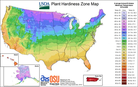
The new map is based on average annual extreme minimum temperatures from 1976 to 2005, whereas the previous map used data from the years 1974-1986. Average temperatures throughout the U.S. were about two-thirds of a degree (F) higher in the more recent time span then they were from 1974 to 1986. As a result, the zones have shifted, and many locations around the country are now in warmer zones than they were on the previous map. Some states, such as Ohio, Texas, and Nebraska, have almost completely migrated to a warmer zone. Of the 34 cities highlighted in the 1990 map, 18 are in warmer zones in the updated version of the map. In general, much of the U.S. is about one-half zone warmer in the new map than in the 1990 edition.
The 2012 version of the planting zones map is the first that is GIS-based. Additionally, a new algorithm used for the 2012 edition enabled more accurate interpolation between weather reporting stations, and the new map also accounts for factors such as elevation changes and proximity to bodies of water, which led to more accurate mapping of the zones. Data used to create the map came from a total of 7,983 stations in the U.S., Canada, and Mexico, including stations of the National Weather Service, the Natural Resources Conservation Service, the Forest Service, the Bureau of Reclamation, the Bureau of Land Management, Environment Canada, and the Global Historical Climate Network.
An in-depth overview of the new map was published in February’s Journal of Applied Meteorology and Climatology. An interactive version of the map and more features can be found here.
Uncategorized
Some Good Choices for Your Bookshelf
The Atmospheric Science Librarians International (ASLI) announced their ASLI’s Choice Award winners for 2011 on Wednesday afternoon in the exhibit hall. The awards, now in their seventh year, are presented for the best book of the year in the fields of meteorology/climatology/atmospheric sciences and are judged in the following categories:
- uniqueness
- comprehensiveness
- usefulness
- quality
- authoritativeness
- organization
- illustrations/diagrams
- competition
- references
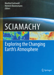
In keeping with the Annual Meeting’s technology theme, the winning book in the science category was SCIAMACHY: Exploring the Changing Earth’s Atmosphere, edited by Manfred Gottwald and Heinrich Bovensmann, published by Springer. ASLI noted the book provided a “comprehensive summary of the milestone SCIAMACHY mission from its initial conception to most recent results.”
There were two honorable mentions in the science category: The Global Cryosphere: Past, Present and Future, by Roger G. Barry and Thian Yew Gan, published by Cambridge University Press, awarded for “the depth and breadth of its coverage of the major aspects of the cryosphere”; and Physics and Chemistry of Clouds, by Dennis Lamb and Johannes Verlinde, published by Cambridge University Press, for “its data-rich, yet readable exploration of clouds across a range of scales.” 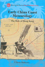
Awards were also given in the history category. The winner was Early China Coast Meteorology: The Role of Hong Kong, by P. Kevin MacKeown, published by Hong Kong University Press, which ASLI lauded for “its account of the scientists and science that comprise the history and accomplishments of the Hong Kong Observatory.” Honorable mention in the history category went to The Warming Papers: The Scientific Foundation for the Climate Change Forecast, edited by David Archer and Ray Pierrehumbert, published by Wiley-Blackwell, awarded “for a compendium of the key scientific papers that undergird the global warming forecast.”
Congrats to all the winners, and it’s never too early to start thinking about next year’s meeting: If you read a good book published this year, you can nominate it for the 2012 award at this page.
Broadcast Meteorology Award Winner Says 'Be Yourself' On-Air
Bob Ryan, meteorologist for WJLA-TV in Washington, D.C., is the 2012 recipient of The AMS Award for Broadcast Meteorology. Ryan is being honored with this annual award in recognition of a career based on personal integrity and dedication to advancing the science of meteorology through broadcasting, education, promotion of safety, and support of colleagues.
Established in 1975, the AMS Award for Broadcast Meteorology recognizes a broadcast meteorologist for sustained long-term contributions to the community through the broadcast media, or for outstanding work during a specific weather event. Ryan, who has been a fixture in Washington TV News for more than three decades, will receive the award at the 92nd AMS Awards Banquet Wednesday evening in New Orleans.
The Front Page caught up with him to learn about how he connects with viewers when on-air and with his colleagues within the AMS. His primary advice for future broadcast meteorologists: “Be yourself,” he says, “and again, you’re talking to one person.” You can view interview below.
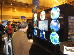
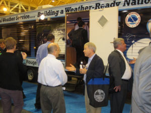
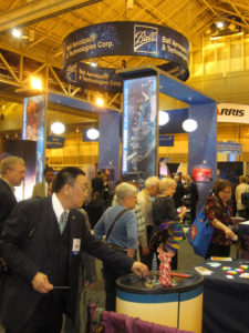
Big Exhibits in the Big Easy
More photos up on Flickr.
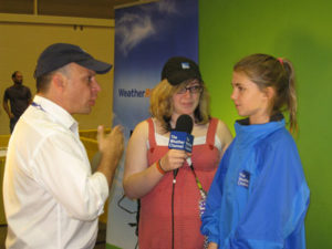
WeatherFest and All That Jazz
More photos up on Flickr.


Learning to Live with Floods
We all know floods are not friendly. But the NWS and the nonprofit environmental organization Nurture Nature Center (NNC) are taking a new approach to flood education by accepting they are a part of nature that at times cannot be avoided, but can certainly be mitigated. This week’s 21st Symposium on Education will include a poster on the NNC/NWS partnership.
After a series of severe flood events in the Delaware River Valley, the NNC started “Floods Happen. Lessen the Loss,” an education program that emphasizes adaptation over prevention, acceptance over angst, and most importantly, education over ignorance. The program not only provides resources (including interviews with flood experts) and tools, but it also explores the deeper issues of how flooding affects communities and how those communities can live with and adapt to floods. This community-based approach to flood preparation is captured in this animated short film created by the NNC.
One of the key themes of the program is helping communities and individuals learn how to help themselves and then take the initiative to do so. For example, a new NWS flood warning system using Push technology sends out alerts to individuals’ e-mail addresses, internet browsers, and some cell phones . . . but only if the individual takes action and signs up for the alerts. (This link provides a how-to for signing up.) In this video, the NNC’s Rachel Hogan Carr explains how the program addressed another problem–the semantics of the term “100-year floodplain”:
The commonly used, but misleading concept, is the 100-year flood, which leads people to believe falsely that major flooding will occur only every hundred years on average. The truth is that even smaller storms can produce tremendous damage. In many areas along the Delaware River, the flooding in 2004, ’05, and ’06 was much smaller than a 100-year flood, but the damage was nonetheless extensive. And that’s just one problem with the term. The other is that many areas well outside the hundred-year floodplain are liable to flooding, too. In fact, nearly 30% of national flood insurance claims come from outside the 100-year floodplain, often in places where people thought they were safe. That’s why Nurture Nature has started using the terms high, moderate, and low risk to describe various regions of the floodplain.
The NWS/NNC collaboration now has a second initiative: the placement of NOAA’s Science on a Sphere at the NNC’s flood museum, and the creation of the first Science on a Sphere flood-related program, which will explain how climatic and oceanic changes are contributing to the increasing frequency and severity of floods throughout the world.
Get Your Meeting Photo Fix
After you check The Front Page, Twitter, Facebook, and the AMS YouTube channel for the latest happenings at the Annual Meeting, make sure to take a look at the photos on Flickr.
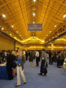

For more shots of the Career Fair and scenes around town, take a look here. Make sure to check back daily to see the latest events.
A Statement on Statements: Works in Progress
Today at its annual January meeting, the AMS Council will hear a report from a committee of expert members on the progress of a new revision to its Information Statement on Climate Change.
To say that the AMS’s current statement on this topic is “oft-cited,” particularly by advocates of strong action to mitigate and adapt to climate change, would be an understatement. It represented the best of climate science when it was adopted in February 2007, and includes such wording as:
strong observational evidence and results from modeling studies indicate that, at least over the last 50 years, human activities are a major contributor to climate change
And
increases in greenhouse gases are nearly certain to produce continued increases in temperature.
But despite the importance of keeping the public up to date on advancing climate science, don’t expect any major decisions in New Orleans. In fact, adoption of the updated Statement isn’t even on the Council’s agenda.
Actually, approval of the update would be forbidden by Council policy that requires a 30-day period to allow comments by members. Back in September, the Councilors ensured this by voting nearly unanimously for various enhancements, simplifications, and clarifications in the draft presented at that time. No new draft has yet been presented, though participants in the process report considerable progress. The Council has the option to extend the term of the Statement currently in force while the drafting committee continues its work.
This slow deliberative style is routine for an organization that has greatly expanded, diversified, and matured scientifically in its 92 years. At last year’s meeting, a proposed revision to the Statement on Mobile Homes and Wind Storms was considered. The Council liked the idea enough to approve a revision, suggesting that the “statement be broadened somewhat.” A year later and, still, the new Statement has not been released, even while deadly tornadoes have dominated the news. In fact, in 2011the Council approved only one statement—about Green Meetings.
At last January’s meeting in Seattle the Council decided to set up a committee to review statements that might need revision. The progress on all of these will be slow and iterative—by design.
“We don’t want to say anything unless it’s something we know,” one Council member said this weekend.
In this sense the standard for approving Statements is even more stringent than it is for accepting articles for the scientific journals. Peer review often at least leaves open the idea that results of a well designed and executed study might be invalidated, at least in part.
There’s no allowance for committees sitting up late burning the midnight oil drafting a perfect text to usher in a decision, either: an AMS Council policy doesn’t allow it. When a Council-appointed committee of members finally hands in a draft that the Council feels is good enough, the Statement is only then ready for the 30-day comment period that precedes the Council’s final review and possible approval.
Meanwhile, drafts more often than not shuttle back and forth between the Council and the drafting committee until the exact wording is settled.
In the case of the Information Statement on Climate Change, the anticipated completion date, initially hoped for 1 February 2012, has long been impossible. But the proof of the process, though slow, has its intended effect. Advancing science may eventually require that statements be updated and revised, but statements generally have a long lifetime in the public eye.
Get a Clue! (at the AMS Student Conference)
Hi AMS Student Conference Attendees,
Hope you’re having a great and productive day! Here’s your clue for the contest:
__ + __ + __ + __ + __ + __ + __ + __ = final answer
A U S T I N T X
1. Determine how many times each of the letters in ‘AUSTINTX’ appears in the puzzle. For example,  if the letter ‘A’ appears ten (10) times in the puzzle, then write the number 10 above the A. If a letter does not appear in the puzzle then insert a value of -1 above the letter. For example, if the letter ‘A’ appears zero (0) times in the puzzle, then write the number -1 above the A.
2. Then, solve the equation to arrive at the final answer.
Submit your final answer, along with all required information, to:
https://catalyst.uw.edu/webq/survey/swright/119394
Your answer must be submitted by 9:00am(CST) on Sunday, 22 January 2012.