New AMS Book Remembers the Great New England Hurricane

It has been known by many names: the Yankee Clipper, the Great New England Hurricane, the Long Island Express . . . or simply the New England Hurricane of 1938. With fatalities estimated at between 500 and 700, it’s still the deadliest hurricane in modern New England history, and only Sandy last year was more costly (property damage from the ’38 storm amounted to almost $5 billion in 2013 dollars). Tomorrow is the 75th anniversary of the storm’s landfall as a Category 3 hurricane on Long Island, and to coincide with that occasion, the AMS has just released a new book about the event: Taken by Storm, 1938: A Social and Meteorological History of the Great New England Hurricane, by Lourdes B. Avilés. (To order the book, visit the AMS bookstore.) The first book to detail the science of the storm, it also delves into the Great Hurricane’s significant societal impacts. In the preface, Avilés discusses her motivation for writing the book:

My goal has not been to retell the story that has already been told, although there has to be some of that too, but to take a somewhat interdisciplinary approach to weaving together different aspects–different stories–of the 1938 Hurricane. This includes what happened before, during, and after the event, in the context of the meteorological history of the storm and its associated destruction and devastation; casualties, survival, and recovery in the affected population; environmental and geological changes caused by the storm; the science of hurricanes and of early-20th-century meteorology; and, finally, the added perspective of other intense hurricanes that have affected and no doubt will again affect the region.

AMS Director of Publications Ken Heideman, who wrote the foreword to Taken by Storm, 1938, recently talked to Avilés about the hurricane and her new book; the complete interview is below.
 

Give Solar Energy a Boost–and Win a Prize

We’re nearing the halfway mark on the AMS 2013-2014 Solar Energy Prediction Contest. Right now the leaderboard is headed largely by teams that participate the most, but there’s still time to join in if you want to have a chance at a prize.

The 130-day contest opened on July 8 and closes on November 15. It is run by the AMS Committees on Artificial Intelligence Applications to Environmental Science, Probability and Statistics, and Earth and Energy, which began reaching out to a wider community of participants last year by hosting the contest on the website, Kaggle. More than 90 teams are trying their skill with statistical and machine learning techniques. The daily challenge is to predict incoming solar energy at a preselected set of 98 Oklahoma Mesonet sites that serve as a virtual solar farm.

Hopefully, the contest will show “which statistical and machine learning techniques provide the best short-term predictions of solar energy production,” say the organizers, Amy McGovern and David John Gagne II of the University of Oklahoma. “Power forecasts typically are derived from numerical weather prediction models, but statistical and machine learning techniques are increasingly being used in conjunction with the numerical models to produce more accurate forecasts.”

The contest website provides input numerical weather prediction data from the NOAA/ESRL Global Ensemble Forecast System (GEFS) Reforecast Version 2. Data include all 11 ensemble members and the forecast time steps 12, 15, 18, 21, and 24 provided in netCD4 files. There’s also a training dataset and a public testing dataset. Basically all you have to do is jump right in and see how well your methods work.

Teams identified as preliminary winners (based on mean absolute error, a common metric in the renewable energy industry) will submit their code to the judges after the contest for verification. The verified winners will make their code open-source, and will be honored (and expected to present) at the AMS Annual Meeting in February 2014 in Atlanta.

The prizes are sponsored by EarthRisk Technologies, Inc., and include $500 awarded to the winner, $300 for second place, and $200 for third. Each of the top three gets their abstract fees waived for the upcoming AMS Annual Meeting, and the top student forecaster gets both abstract fee and conference registration waived.

Daily solar energy data were provided by the Oklahoma Mesonet with the assistance of Jeffrey Basara of the Oklahoma Climatological Survey. The GEFS Reforecast Version 2 data were developed and provided by Thomas Hamill of NOAA.

AMS Broadcast Conference Talks Now Available Online

When it comes to broadcast meteorology, it’s never too early to begin networking. Matthew Cappucci—15 years old and perhaps the youngest person to give a presentation at an AMS conference—kicked off his talk at the 41st Conference on Broadcast Meteorology by noting he’d be ready for the workforce in six years if anyone was interested. His presentation on gust-front waterspouts was met with an enthusiastic response from the broadcasters and personal accolades from Harvey Leonard, chief meteorologist at WCVB-TV in Boston, who joked that Cappucci could have his job in less than six years.
As notable as Cappucci’s research and presentation was, more impressive is the fact that his work with the local NWS office in Taunton, Massachusetts, has resulted in them adding additional statements to their severe thunderstorm and special marine warnings. His goal is to have other offices adopt the new warning criteria and also have broadcasters use these parameters in alerting the general public regarding threatening weather, including gust-front related waterspouts.
Cappucci’s talk can be found here, and the AMS website now has recordings of numerous great presentations from the conference that took place in Nashville in June.  The meeting featured recent research in climate change, communication, and educational programs; a few of the presentations that got the conversation flowing among attendees were:

  • James Spann, broadcast meteorologist in Birmingham, Alabama, relayed his personal experience on the generational tornado outbreak of April 27 2011, noting that despite excellent warnings, the loss of life was exceptionally high and unacceptable. Being on traditional television and radio and using social media isn’t enough, he says; broadcasters need to use it correctly to be effective.
  • Sheldon Drobot of NCAR presented the development and testing of the mobile alert warning (MAW) application, which blends traditional weather information with mobile vehicle data to get current weather conditions and provides them to users through web and phone applications. His paper on MAW has recently been accepted to BAMS and will be published in an upcoming issue.
  • The panel session on “Naming Winter Storms” included the NWS’s stance by John Ferree, Susan Jasko’s communication perspective on the power involved in naming, and Bryan Norcross on The Weather Channel’s decision to name the storms and how they went about it.

Norcross also spoke on the “Lessons from Hurricane Sandy on Evacuation Communications,” exploring how the threat might have been better characterized to convey the possible expected coastal effects and resulting danger.
And if you want more from Cappucci, he also wrote an article on Hurricane Sandy for a local paper, which can be read here.  Not bad for someone who still has two years of high school to complete.

Intelligent Transportation Systems: A Drive-By Opportunity

A market research report released this month predicts that vehicle fleet management solutions, involving both software and hardware, will balloon from a $10 billion to a $30 billion industry within five years. The Dallas-based company Markets and Markets cites not only growing numbers of planes, trucks, cars, and ships, especially in Asia, but also several trends that tap the expertise of atmospheric scientists: “The environmental concerns, CO2 emission reduction norms, and fleet operators’ need for operational efficiencies are expected to serve as major drivers for the fleet management market.”
The report echoes the message of another report issued just a month ago by the market research firm, Technavio, which touted double-digit growth in the global intelligent transportation systems markets through 2016.
This can only be good news for a weather community that is already essential to fleet management in the aviation and maritime industries, right? Well, maybe. Especially in the area of smart surface transportation, the opportunities are huge, but everything depends on yet-to-be specified, rapidly evolving markets and technologies. This is a formative moment in that market–a drive-by opportunity. The chance to embed meteorological priorities in this burgeoning field–specifically, equipping vehicles to report key environmental variables to the meteorological community–may pass by quickly. Hence, several years ago an AMS Annual Partnership Committee on Mobile Observations was asked to “articulate a clear vision for mobile data that captures the immense opportunities for these data to improve surface transportation weather services.”
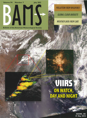
The resulting report is available on the web (here). However, in case you don’t have time to read all 88 pages there, or if you missed the multiple sessions on transportation at this week’s AMS Summer Community Meeting, you have another option. Read the shorter version of the report, by William Mahoney and James O’Sullivan, in the July issue of BAMS.
The article, “Realizing the Potential of Vehicle-Based Observations,” stresses that the involvement of meteorology in intelligent vehicle systems is not a given—our community has to be engaged in the broader technological efforts that are already underway.

Whether this opportunity is acted upon or missed (at least initially) will depend greatly on the weather community’s technical understanding and eventual adoption of … unique datasets and their level of participation in connected vehicle initiatives within the transportation community.

The stakes are obvious, both in getting real-time weather information to drivers and in getting that data into the hands of the atmospheric science community. More than 7,000 people are killed, and more than 600,000 are injured, annually in weather related accidents on the road. Meanwhile,

the availability of hundreds of millions of direct and derived surface observations based on vehicle data will have a significant impact on the weather and climate enterprise. The potential improvements in weather analysis, prediction, and hazard identification should have a large positive effect on all weather-sensitive components of the U.S. economy and the capability to sense the lower atmosphere at finer scales than traditional observation systems, which will improve the detection and diagnosis of extreme weather events that affect lives and property.

It’s no accident, then, that meteorologists are eyeing your car as the observing platform for this future transformation. Mahoney and O’Sullivan detail some of the possibilities:

Vehicle-based air temperature observations could provide additional temporal and spatial specificity required to more clearly identify rain/snow boundaries; also, antilock brake and vehicle stability control event data could support the diagnosis of slippery pavement conditions. Even the most common components of the vehicle can begin to tell a story about the near-surface atmospheric and pavement conditions through the intelligent utilization of vehicle data elements, such as windshield wiper state, external air temperature, headlamps, atmospheric pressure, sun sensors, vehicle stability control, and the status of an antilock breaking system.

For all the benefits of vehicle-based observing networks, however, there are significant challenges. For example, Mahoney and O’Sullivan note, “Traditionally, near-surface weather observations have been generated by stationary platforms. Taking observations from mobile platforms, particularly passenger and fleet vehicles, introduces new dimensions of complexity.” In addition, among other obstacles:

Many of the normal concerns associated with dedicated weather sensors—siting, maintenance, and calibration—are exacerbated with mobile sensors, especially when large numbers are to be sited on a wide variety of vehicles driven by people with varying interest in those sensors. The best place to site a temperature sensor on a particular model of car may not be the best location for a pressure sensor, and the best place for a particular sensor on one model of car might not even exist on another model.

Beyond the hopes of placing dedicated weather sensors on cars, there are, of  course, existing engine sensors and weather-related vehicle behavioral data:

This type of information could be made available quickly without deployment of new sensors, it is considered to be the “low-hanging fruit” of mobile weather sensing. However, it presents some very challenging calibration issues and may ultimately not provide consistent enough information for weather applications.

There are also communications challenges: one intelligent transportation solution that is gaining traction involves direct, dedicated short-range vehicle-to-vehicle communications links between cars sharing the road. The weather community, by contrast, will require longer-range communications solutions to gather information from vehicles; somehow short-range, on-the-road links will need to be integrated with other options such as existing cellular networks creates new challenges .
Meanwhile, there are not just technical but also fiscal and institutional—perhaps legal and regulatory—barriers to successful implementation of the roadway network goals. The report emphasizes that there are solutions to these barriers, even though “a litany of barriers…may leave … the impression that mobile weather observing is too difficult, too costly, or otherwise too problematic to achieve on any useful scale.”
The institutional barriers make plain why improving forecast services for transportation was a vital one for consideration during the high-level considerations at the AMS Summer Community meeting, and by all of us in the weather and climate community. Mahoney and O’Sullivan show that the challenge of emerging roadway systems is an opportunity to shape development of the weather community and how it works:

Management of highways and the traffic they carry involves a large number of active participants, including the federal government, states, counties, municipalities, and regional authorities. In addition, the immature nature of road weather management offers numerous opportunities for entrepreneurial innovation, opening the door for commercial entities with potentially unconventional approaches to deploying mobile weather sensors and managing and exploiting the data from those sensors. At this point, it is not clear that, with all the various participants with their differing needs and agendas, the mobile weather observing enterprise is manageable in the normal sense of the word. In any case, there is no overall authoritative vision for the deployment, operation, management, and governance of mobile weather observing capability, let alone a high-level strategy, concept of operations, or implementation plan.

The Moore Tornado from Above

The July issue of BAMS includes a feature on the new and improved imaging capabilities of the Visible Infrared Imaging Radiometer Suite (VIIRS), one of the five instruments aboard the Suomi NPP satellite. The cover montage highlights VIIRS’s expanded spectral aptitude and microscale resolution by depicting july_bams_coverthree different perspectives on the tornado outbreak that swept across the Midwest on May 20, culminating in detailed nighttime evidence of the track of  devastation in Moore, Oklahoma, as detected on May 21.
That month, the instruments on Suomi NPP were being calibrated by aircraft that in many cases flew directly under the path of the satellite. On May 20, one of these planes–an ER-2 flying above the cloud cover at approximately 65,000 feet–used the MODIS/ASTER Airborne Simulator (MASTER) to capture images of the storm that brought the EF5 tornado to Moore. The image below shows the tornado system minutes before it reached the city, and is overlaid on a Google Earth map to show the tornado location.

oklahomazoom2
(Image credit: Google Earth/Ames Airborne Sensor Facility/Rose Dominguez)

Annual Meeting Updates

Philip Ardanuy and Eileen Shea, the co-chairs of the 2014 AMS Annual Meeting, and AMS President J. Marshall Shepherd recently sent out this message with updates about the meeting:

Dear Colleagues and Friends of the AMS,
We are happy to announce that most of the conferences have decided to extend their abstract submission deadline. You can view all of the call for papers and updated abstract deadlines here.
Additionally, registration rates have been posted on the AMS 94th Annual Meeting web page and links to register for the conference are now active.
The preregistration (discounted registration) deadline this year is:
2 December 2013
Please remember that ALL attendees must register in order to attend and present at the conference. Registration is separate from the abstract submission fee.
Hotel reservation blocks will open and links to make those arrangements will be available on 5 August.
Thank you in advance for booking at an AMS-contracted hotel, since revenue from sleeping rooms helps offset other meeting costs and is passed down to attendees in keeping registration rates to a minimum.
Thank you and see you in Atlanta!
 
Phil Ardanuy and Eileen Shea
Co-Chairs, 2014 AMS Annual Meeting
J. Marshall Shepherd
AMS President

Annual Meeting Abstract Deadline Is August 1

Philip Ardanuy and Eileen Shea, the co-chairs of the 2014 AMS Annual Meeting, and AMS President J. Marshall Shepherd recently sent out this message about submitting abstracts for the meeting:

Dear AMS Colleagues,
It’s hard to believe that we’re already actively gearing up for the 2014 AMS Annual Meeting, to take place 2-6 February 2014 in Atlanta, Georgia! With this year’s theme: “Extreme Weather—Climate and the Built Environment: New Perspectives, Opportunities and Tools,” we’re confident that you’ll find lots of interesting, thought-provoking, professionally rewarding, and personally satisfying interactions. Recent events like Superstorm Sandy, the Oklahoma Tornadoes, and flooding in Calgary highlight the importance of the meeting theme, which is increasingly relevant to the science and operational communities, and society as a whole. The theme combines scientific inquiry, technological advances, societal implications, and public awareness through the lens of past, current, and future extreme weather and climate events.
This note is to remind you that the deadline to submit an abstract is fast approaching: 1 August 2013.  Check out the AMS 94th Annual Meeting Web Page: http://annual.ametsoc.org/2014/. Here, you can find more details on the Annual Meeting theme as well as links to the Call for Papers for each participating conference, and links to submit your abstract online. All other information pertinent to the meeting will be posted to that page as it becomes available.
An abstract fee of $95 (payable by credit card or purchase order) is charged at the time of submission (refundable only if the abstract is not accepted).  The abstract fee includes the submission of your abstract, the posting of your extended abstract, and the uploading and recording of your presentation to be archived on the AMS website. For poster presenters, you will also be able to submit a PDF file of your poster presentation for online viewing. Authors will be notified of acceptance by the beginning of October.
Even if you choose not to submit an abstract for the 94th AMS Annual Meeting, we hope you will come to listen, discuss, learn, and connect with colleagues. Continue to check out the AMS Annual Meeting website for new information on themed joint sessions, scientific and technological presentations, opportunities for social interactions, short courses, exhibiting details, registration, hotel and local area information, and much more.
Be sure to also follow Annual Meeting developments on The Front Page.
See you in Atlanta!
 
Philip Ardanuy and Eileen Shea

Co-Chairs, 2014 AMS Annual Meeting

J. Marshall Shepherd

AMS President


New Map Peeks Under Antarctic Ice

With data compiled from a number of satellite, aircraft, and surface-based surveys, the recently completed Bedmap2 project comprises three datasets to map the ice-covered continent of Antarctica: surface elevation, ice thickness, and bedrock topography. The new dataset updates 2001’s original Bedmap compilation with tighter grid spacing, millions of additional data points, and extensive use of GPS data—enhancements that have improved the dataset’s resolution, coverage, and precision. For example, it depicts many surface and sub-ice features that were too small to be visible in the original Bedmap. Data from Bedmap2 reveal that Antarctica’s average bedrock depth, deepest point, and ice thickness estimates are all greater than that recorded in the original Bedmap.
As outlined in the NASA video below, the updated information obtained from Bedmap2 should enhance currently limited data on the continent’s ice thickness and what is beneath the ice, which could help researchers better understand how Antarctica will respond to a changing climate. It also “will be an important resource for the next generation of ice sheet modelers, physical oceanographers, and structural geologists,” according to the British Antarctic Survey’s Peter Fretwell, lead author of a recently published article on Bedmap2 that appeared in The Cryosphere. The article and Bedmap2’s data can be accessed here.

Pubs Department Gets the Word(s) Out

At last month’s meeting of the AMS Publications Commission–which mostly comprises the Chief Editors of the Society’s scientific journals–many of the attendees were concerned that their fellow AMS members may not be aware of the many recent notable achievements by AMS Publications. So with that in mind, here’s a quick list of some of the accomplishments over the past year:

Of course, all of this was done in addition to the continued publication of AMS’s journals, 6 of which were ranked in the top 20 for impact factor in the most recent edition of the Thompson-ISI rankings.
And out of everything discussed at the meeting, the Publications Commission was perhaps most adamant about publicizing the rapidly improving production time of those journals. Production times for AMS journals (the number of days between when a paper is accepted and when it is published in final form) have been declining for years, and in May of this year the average production time for all journals was just over 150 days. In January of 2008, it was around 280 days. That improvement has been accomplished despite a continuing rise in article submissions, which reached an all-time high of 2,999 in 2012. AMS journals published almost 27,000 pages last year.
“Publishing in AMS journals now is much faster, more efficient, and streamlined than even just a few years ago, and the word seems to be getting out; submissions are at an all-time high and continuing to increase,” says AMS Director of Publications Ken Heideman. “Our goal is not just to get you to publish with us but to keep you publishing with us!”
At the meeting, Heideman underscored the ongoing commitment of his staff to continually reduce production times, and highlighted a number of initiatives for the department in the upcoming year.
Keep an eye out for an article in BAMS later this year with more detailed highlights from the Publications Commission meeting.

A Scientist's Scientist

Joseph Farman–the man who found the ozone hole–had a very straightforward, unglamorous way of describing the work of  a scientist:

Science is thinking you know how things work and so you make something work and it either works as you think it does or it doesn’t work as you think it does and now you move on.

Farman, who passed away last month at the age of 82, reported the existence of the ozone hole in a 1985 paper based on in situ measurements made with Brian Gardiner and Joe Shanklin in Antarctica.  Despite the renown that followed this discovery, Farman’s legacy will stand–as he wished–on a dogged ability to follow his simple model of research at the highest level.
An employee of the British Antarctic Survey from 1956 until his retirement in 1990, Farman ventured to Antarctica at the beginning of his career and studied the atmosphere over that continent for 25 years, assigning other scientists to continue measurements after he returned to Britain in 1959. His superiors questioned his indefatigable efforts to compile ground-based ozone readings–after all, NASA satellites were already monitoring the ozone over Antarctica. Farman told the BBC:

The long-term monitoring of the environment is a very difficult subject. There are so many things you can monitor. And basically it’s quite expensive to do it. And, when nothing much was happening in the environmental field, all the politicians and funding agencies completely lost interest in it. And there was a huge struggle to keep going. And in fact we could have been closed down with our ozone measurements the year before we actually published our paper.

But Farman was a strict proponent of the simple scientific act of collecting data–“just doing a little job, and persevering at it,” as described by Sharon Roan, author of Ozone Crises: The 15-Year Evolution of a Sudden Global Emergency. This commitment to scientific principles made him “a model scientist,” according to Roan.
Faithful dedication to the scientific process yielded momentous results. Isn’t that how it’s supposed to work?
This New York Times obituary tells a more complete story of Farman’s achievements, and for those who really want to delve into his life and sometimes controversial views, there is this interview collected by the British Library (audio version available here).