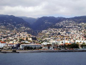
The Portuguese archipelago of Madeira, nestled in the Atlantic Ocean off the coasts of Portugal and northern Africa, is normally a subtropical island paradise. But severe flooding on the island last weekend created a disaster that killed dozens and has local environmental leaders blaming the urban planning in the region as much as recent heavy rainfall. They believe that extensive development on the island of about 250,000 people over the last few decades created conditions that exacerbated the severe weather that struck over the weekend, when more than 11 cm of rain per fell in 5 hours in the town of Funchal–more than 15% of what it normally receives in an entire year.

“The situation has gradually been aggravated due to land-use zoning problems and errors committed on the island,” said Hélder Spínola of Quercus, a Portuguese environmental organization. These “errors” include the development and paving of land along the coast and near waterways and disruption of the flow of Madeira’s three largest rivers. During the recent storm, the rivers overflowed, storm runoff did not effectively drain into the ground, and much of the water was forced into drainage channels that were unable to hold the tremendous amounts of rain. As a result, raging rivers of mud and debris stormed down the hillsides, plowing through roads, buildings, bridges, and anything else in their path. Adding to the problem was the absence of a weather radar in Madeira, which prevented an accurate forecast of the unusually strong storm.
While local government officials denied that faulty planning and overdevelopment were to blame for the catastrophe, research has long shown that urbanization increases frequency of flooding. For example, an upcoming article by Yang et al. in the Journal of Hydrometeorology finds that when the impervious surfaces cover more than a mere 3-5% of the total area in a watershed, there is a statistically significant effect on streamflow.