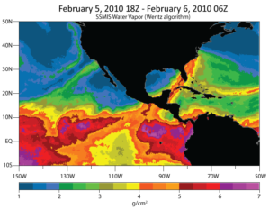
This week NOAA announced installation of four new special observatories in California dedicated to improving the understanding–and forecasting–of atmospheric rivers, the massive (but narrow) flows of tropical moisture aloft in the warm conveyor belt of air ahead of cold fronts.

The timing of the announcement could not have been better. Ocean-fed storms with the distinctive filaments of tropospheric moisture brought heavy rains to California and Oregon this past week. Lake levels in northern California surged by as much as 34 feet; rush hour in major cities like San Francisco were bedeviled with flooded streets and bridges blocked by overturned vehicles due to the high winds carrying blinding sheets of rain.
The timing was not just good from a weather point of view but also from the standpoint of public understanding. The announcement culminated the fast-track rise of “atmospheric river” from an obscure technical term to popular understanding. In anticipation of the weekend deluge (and the lesser encore Wednesday), media outlets from Oregon to Minnesota to Australia picked up the vibe and were talking about atmospheric rivers–and not just by the more time-honored and familiar regional name, “Pineapple Express.”
It was only 20 years ago the term “atmospheric river” was introduced in a scientific paper by Reginald Newell and colleagues; then atmospheric rivers got a brief spate of publicity during the late 1990s and early part of this century with airborne field projects over the Pacific Ocean, such as CALJET and PACJET. Attention ramped up again during 2010’s infamous Snowmaggedon on the East Coast.
So it goes with atmospheric sciences, where the prospect of applications can drive quick adoption of useful concepts: useful not just in forecasting but also in climatology. For example, at the upcoming AMS Annual Meeting, Tianyu Jiang of Georgia Tech will look at different resolutions of general circulation models to see how well they depict these detailed structures (as little as 25 miles wide) and linkages with East Asian Cold outbreaks in a Tuesday poster session (9:45 a.m., Exhibit Hall 3). In a Monday poster (2:30 p.m., Exhibit Hall 3) Nyssa Perryman of Desert Research Institute will explore how downscaling from a global climate model to an embedded regional climate model can affect the simulation of atmospheric rivers.
The importance of this relatively new concept is such that the AMS Education Program devoted several sections to atmospheric rivers and how they transport water vapor from the tropics in its newest edition of the AMS Weather Studies textbook. Released in August 2012 by the AMS Education Program, the book is currently being used by thousands of college students nationwide as an introduction to meteorology. A QR code was embedded in the text to provide readers with access to the most current forecast information and video loops available on the subject.
For more on atmospheric rivers, check out Ralph and Dettinger’s article in the June 2012 BAMS on the relative importance of atmospheric rivers in U.S. precipitation. Marty Ralph discusses the article in this AMS YouTube Channel video: