If another storm like Sandy threatens land while on the cusp between tropical and extratropical classification, National Hurricane Center (NHC) forecasters will have a green light to issue or maintain watches and warnings as well as advisories, even after transition.
That’s the policy change NWS/NHC made this week after months of animated debate among forecasters, weather broadcasters, and emergency managers. The changes will take effect at the start of the 2013 Atlantic hurricane season, June 1.
The shift—from watches, warnings, and advisories only being posted by NHC when a storm was expected to be strictly tropical as it came ashore to now being allowed for what it terms “post-tropical” storms at landfall—was borne of a critical firestorm.
Despite the enormous threat from Sandy last October, NWS and NHC decided not to hoist hurricane watches and warnings for the northeastern coast of the United States because the monster storm wasn’t forecast to land its center on shore while still a hurricane. The re-classification of Sandy as post-tropical would have forced such alerts to be dropped mid storm, which they argued would cause confusion.
Critics of the decision claimed that people in harm’s way didn’t take the storm seriously because there weren’t any hurricane warnings in place. Nearly 70 people died in the United States directly from Sandy’s surge and wind.
The fallout included broad discussions of the difficulty forecasting Sandy. At an AMS Town Hall Meeting in Austin, Texas, in January, Louis Uccellini (then director of NOAA’s National Center for Environmental Prediction) said that NWS and NHC forecasters had anticipated Sandy transitioning from a hurricane to an extratropical storm, but they expected it to happen sooner than it actually did. In his presentation, he also noted that the primary operational forecast model used by the NWS (the Global Forecast System, or GFS, model) had performed the best of all models during the 2012 Atlantic hurricane season, but when it counted—with the season’s only two landfalling U.S. storms of hurricane intensity (Isaac and Sandy)—it had the worst forecasts.
“When you don’t hit the big one, people notice,” he said.
Compounding the uncertain model forecasts was what to do with the warnings if the transition occurred prior to landfall. NHC Director Rick Knabb discussed this at the same AMS Town Hall meeting, calling it the “Sandy warning dilemma.” He agreed that hurricane warnings would have been best, because they’re familiar and grab your attention. But, because of the looming transition, discussions among NHC and NWS forecasters as well as emergency managers and local and state authorities, including one governor, stressed that the warning type not change during the storm for fear of confusing the message during critical times of preparation and evacuation. Due to the structure for hurricane warnings in place at the time, which would have forced NHC to drop them once the transition occurred, NHC and NWS forecasters opted not to issue a hurricane warning for Sandy.
“We wanted to make sure the warning didn’t change midstream, and we could focus on the hazards.”
Ultimately, calls settled on a way to effectively communicate the threat of dangerous winds and high water regardless of a storm’s meteorological definition. A proposal surfaced during the Town Hall that would broaden the definition of tropical storm and hurricane watches and warnings and include post-tropical cyclones, whose impacts still pose a serious threat to life and property.
Knabb credits the candid nature of the months-long debate, with its criticisms and recommendations, for the now-approved proposal. He says it will allow NHC and NWS forecasters as well as the emergency management community to focus on what they do best.
“Keeping communities safe when a storm threatens is truly a team effort and this change reflects that collaboration.”
AMS2013
Hurricane Sandy: NHC Final Report and AMS Town Hall Presentations Online
The National Hurricane Center released its post-storm report on Hurricane Sandy this week, confirming the many nuances of the late-season monster storm we already knew. Yet it’s the details, provided by scientists attuned to getting the minutiae right, that make the report an inviting read.
For starters, the NHC report confirms that Sandy wasn’t a hurricane at landfall. Its core convection collapsed as the center of the storm moved west of the warm waters of the Gulf Stream—the same warm waters that earlier on the day of landfall (October 29, 2012) cranked up Sandy’s winds to 100 mph as the center closed in on New Jersey. Cold air wrapping into Sandy’s center contributed to the collapsing convection, and this structural change transitioned Sandy from tropical to extratropical just 50 miles offshore of Atlantic City.
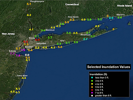
Post analysis of the storm’s intensity in the Caribbean also explains why NHC has now upgraded Sandy to a Category 3 “major” hurricane with 115 mph winds from Category 2, which at the time had been considered the peak classification prior to landfall in southeastern Cuba. The destruction wrought there, described as “especially severe,” included more than a quarter-million homes damaged and 17,000 sheared to pieces by the extreme winds. Gusts topped 110 mph before disabling the anemometer in Santiago de Cuba, the island nation’s second-largest city, and reached an incredible 165 mph at Gran Piedra (“Big Rock,” elev. 2,000 feet) in the national park east of the city. Sandy killed 11 people in Cuba, an unusually high number in a nation that has weathered numerous ferocious hurricanes with lesser loss of life. It was a testament to Sandy’s fury.
Additionally, the report describes changes proposed to NHC’s watch/warning criteria. If adopted, they will address limitations to the use of tropical storm and hurricane watches and warnings when tropical cycl0nes transition to extratropical (i.e., non-tropical or “post tropical”) storms. Facing the potential for Hurricane Sandy to make such a transition prior to striking the Northeast, NHC opted not to issue hurricane watches and warnings north of North Carolina because the transition would force NHC to discontinue them even though the threat for severe wind and tidal conditions remained, which “would cause an unacceptable level of confusion and disruption during critical periods of preparation that included evacuations.” The decision was widely criticized and cited as contributing to the large number of deaths due to storm surge flooding and falling trees in and around New York City.
The report has much more, including details about the record storm tides in New York City, New Jersey, and Connecticut, flooding rain in the mid-Atlantic states, and snow in the Appalachians, as well as a breakdown of U.S. deaths and an abundance of observations.
Town Hall Meeting on Sandy
Recordings of the the presentations made at the AMS Town Hall Meeting on Hurricane Sandy at the Annual Meeting in Austin are now available.
Hurricane Sandy Introduction
Tanja Fransen, NOAA/NWS, Glasgow, Montana
Introduction to Sandy and the Major Impacts
Louis W. Uccellini, NOAA/NWS/NCEP, Camp Springs, Maryland
Hurricane Sandy: Hurricane Wind and Storms Surge Impacts
Richard D. Knabb, NOAA/NWS/NHC, Miami, Florida
Post-Tropical Cyclone Sandy: Rain, Snow and Inland Wind Impacts
David Novak, NOAA/NWS/Hydrometeorological Prediction Center, College Park, Maryland
A Research-Community Perspective of the Life Cycle of Hurricane Sandy
Melvyn A. Shapiro, NCAR, Boulder, Colorado
Communicating the Threat to the Public through Broadcast Media
Bryan Norcross, The Weather Channel, Atlanta, Georgia
Following the Storm through Social Media
Jason Samenow, Washington Post, Washington, D.C.; and Andrew Freedman, Climate Central, New York, N.Y.
Storm Response in New York and New Jersey
Eric Holthaus, The Wall Street Journal, New York, N.Y.
UCAR Videos Bring the Past Back into Focus
For history buffs, YouTube is an incredibly addictive site. Are you a football fan? Maybe you’d like to watch some highlights from games played in 1976. More of a rock ‘n roll enthusiast? Check out the remastered version of the Beatles’ legendary appearance on the Ed Sullivan Show in 1964. But if you’re interested in the history of the atmospheric sciences, maybe you’ve been wondering where you can get your video fix. Now NCAR has the answer: their new YouTube channel. The channel is part of the NCAR/UCAR Archives, which has more than 70 collections in both paper and digital form. NCAR’s Kate Legg highlighted some of the organization’s digital archive highlights in Tuesday’s session on historical perspectives on weather.
The NCAR YouTube channel includes a number of 16-mm films made in the 1960s and 1970s, including scenes from various field projects and educational videos that Legg noted “remind her of film projectors and elementary school.” The channel currently has 30 videos, with new material added on a regular basis. The sample video below was made for the National Scientific Balloon Facility.
ASLI Chooses the Best Books of the Year
The Atmospheric Science Librarians International (ASLI) announced their ASLI Choice Award winners for 2012 on Wednesday afternoon at the ASLI exhibit. The awards, now in their eighth year, are presented for the best books of the year in the atmospheric sciences and are judged in the following criteria: uniqueness, comprehensiveness, usefulness, quality, authoritativeness, organization, illustrations/diagrams, competition, and references.
Awards were given in four categories: science, history, popular, and reference (a new category this year), and in one case a series was honored rather than a book. The winners by category are:
Science
The Future of the World’s Climate (Second Edition), edited by Ann Henderson-Sellers and Kendal McGuffie, published by Elsevier, 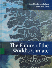 chosen for “the broad scientific context that it provides for current efforts to model and predict climate change.”
Honorable mention–Atmospheric Physics: Background–Methods–Trends, edited by Ulrich Schumann, published by Springer, for its “up-to-date essays on facets of the atmosphere, the methods and instruments used to conduct research in the field, and upcoming research trends.”
History
Hawai’i’s Mauna Loa Observatory: Fifty Years of Monitoring the Atmosphere, by Forrest M. Mims III, published by the University of Hawai’i Press, 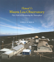 for “its engaging perspective on the scientists, discoveries, and ground-breaking atmospheric measurements done at Mauna Loa Observatory.”
Honorable mentions–Lake Effect: Tales of Large Lakes, Arctic Winds, and Recurrent Snows, by Mark Monmonier, published by Syracuse University Press, for “its clear and accessible examination of lake-effect snow, a regionally important meteorological phenomenon, and how it has shaped the history of the Great Lakes region”; History of the Meteorological Office, by Malcolm Walker, published by Cambridge University Press, for “a thorough account of the scientists, science, and achievements of the Met Office from its earliest beginnings to the present day”; and The Discovery of Weather: Stephen Saxby, the Tumultuous Birth of Weather Forecasting, and Saxby’s Gale of 1869, by Jerry Lockett, published by Formac Publishing, for “a readable history of the evolution of weather forecasting, the Gale of 1869, and Saxby’s prediction of the storm.”
Reference
The Atmospheric Chemist’s Companion: Numerical Data for Use in the Atmospheric Sciences, by Peter Warneck and Jonathan Williams, 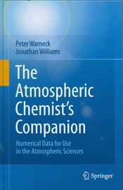 published by Springer, for “its well-organized assembly of frequently needed numerical data and measurement techniques.”
Honorable mention–Kinikmi Sigum Qanuq Ilitaavut–Wales Inupiaq Sea Ice Dictionary, compiled by Winton Weyapuk Jr. and Igor Krupnik, edited by Igor Krupnik, Herbert Anungazuk, and Matthew Druckenmiller, published by the Smithsonian Institution, for “preserving, documenting, and illustrating the terms for sea ice and associated phenomena in the Kingikmiut dialect.”
Popular
Princeton Primers in Climate series, edited by Alison Kalett, published by Princeton University Press, for “for brief, readable books on key topics in climate science that provide essential knowledge and point to further investigation.”
Congratulations to all the winners! Go to the ASLI Choice Award page to find out how to nominate a book for the 2013 awards.
2013 Recipient of Biometeorology Award Aims to Resolve Complex Boundary Layer Interactions
Thomas Foken, professor of micrometeorology at the University of Bayreuth Center of Ecology and Environmental Research in Bayreuth, Germany, is the 2013 recipient of the AMS Award for Outstanding Achievement in Biometeorology. Specifically, Dr. Foken received this award for many contributions, as a researcher and educator, to the understanding and measurement of atmosphere-biosphere interactions and the surface energy balance.
The Front Page caught up with Dr. Foken at the 2013 Annual Meeting in Austin, Texas, to find out more about his research, including his interests in micrometeorology. His described this area of our science as the physics and chemistry of the boundary layer, which encompasses the lowest portion of atmosphere, and the complicated interactions among plants, soils, the oceans, and the atmosphere. He adds that micrometeorologists investigate all the parameters in the global models that are part of this small-scale environment, known as the biosphere or ecosphere. Moreover, he defines biometeorology as an interdisciplinary science that brings meteorologists, soil scientists, and biologists together to better understand the processes that define all of these small-scale interactions so the problems they present within the models can be resolved.
Click on the image below to view the interview.
Broadcast Meteorologist Explains the Climate Change Impacts Already Affecting His Viewers
Chief Meteorologist Jim Gandy of the Columbia, South Carolina, CBS affiliate station WLTX-TV is the 2013 recipient of the AMS Award For Excellence in Science Reporting by a Broadcast Meteorologist. Mr. Gandy received the award and recognition for pioneering efforts to educate viewers about climate change and explaining how it already affects them.
In an interview with the AMS, Mr. Gandy explains how he developed a climate change segment for his Weathercasts called Climate Matters. Each segment focuses on an aspect of climate change that is already showing up where viewers live, work, and play. The Climate Matters stories, including the segment about Poison Ivy and Climate Change that won him the award are posted online for not just his viewers but everyone to watch. He also mentions that the favorable response from his viewers about the segments sparked the creation of a blog for the station he similarly named Weather and Climate Matter.
Click on the image below to view the interview. (Please note that the video portion of the interview has a bit of a lag, and for that we apologize; the audio itself is clear.)
Investigating Tornado Fatalities
Men, particularly the elderly, die at a disproportionately higher rate than other population groups. It’s a well-known fact to those studying tornado fatalities, but what researchers are trying to find is a way to keep more of these high risk men responsive to alerts and therefore save lives.
Wednesday morning at the AMS Annual Meeting, several researchers discussed their research on tornado fatalities. The policy session, chaired by Kimberly E. Klockow of the University of Oklahoma, showed that social sciences and data collection methods are improving the way we can analyze deadly storms and adequately warn the public before these storms strike.
Amber Cannon of the University of Oklahoma started the discussion with a comparison of data from tornado outbreaks in Alabama on 3 April 1974 and 27 April 2011. She noted that, although more people died in the 2011 outbreaks than in 1974, the population density had increased during that time. As a result, the fatality rates very similar.
If the death rate isn’t going up, then maybe we can bring it down. Shadya Sanders, from Howard University, presented her research regarding the super outbreak of tornadoes in 2011. She found that, while a 45% tornado risk seems huge to a meteorologist, the average person may not see the gravity of such a situation. Her work with focus groups has shown the importance of education for children and risk awareness for adults.
Soon, according to Hope-Anne Weldon of the University of Oklahoma, there will be a “one-stop shop” for killer tornado information from the NOAA/NWS Storm Prediction Center. Weldon spent an entire summer filling in gaps in data about tornado victims, clarifying tags of age, gender, and domicile in statistics for 1991-2010–in all 400 tornadoes killing more than 1,100 people. With more detailed data, she noted, social scientists will be able to draw even better conclusions.
The Year by the Numbers
Here’s a statistic for you: 3,300.
That’s the number of attendees (as of Tuesday) at this AMS Annual Meeting.
Here’s another: 1,000.
That’s the lower estimate of attendance at our WeatherFest here in Austin on Sunday.
Here’s another: 2013.
No, that’s not the number of umbrellas sold to meteorologists in downtown Austin yesterday; that’s the year, which happens to be the International Year of Statistics. The American Statistical Association (ASA) and more than 1,400 organizations in 111 countries are combining energies in 2013 to promote statistics. “Statistics2013” will highlight the contributions of the statistics field to finding solutions to global challenges.
“For most people, statistics is an invisible science,” says Ronald Wasserstein, executive director of the American Statistical Association. “Through this yearlong, worldwide awareness campaign, we will remove the veil that cloaks statistics from the public consciousness.”
Such awareness is not difficult to acquire through the programming of the week’s meeting in Austin, with sessions on characterizing uncertainties, data assimilation, Big Data, climate trends, radar algorithms, and so much more. But there’s no better way to kick off Statistics2013 than to attend tomorrow’s poster session (9:45 a.m.) for the Symposium on the Role of Statistical Methods in Weather and Climate Prediction. Bias correction, microphysics parameterization, statistical downscaling, model postprocessing–it’s Gauss in Wonderland.
From the Statistics2013 website:
When many people hear the word “statistics,” they think of either sports-related numbers or the college class they took and barely passed. While statistics can be thought about in these terms, there is more to the relationship between you and statistics than you probably imagine.
And here’s that number, again: 3,300…that’s how many people here at the Austin Convention Center who would heartily agree.
Scenes from the Annual and Austin
The meeting may still be in full swing but it’s not too early to take a look back at some highlights of the past few days. Check out AMS’s flickr page for photos of the student conference, WeatherFest, Keep Austin Beautiful, the Exhibit Hall, and attendees in action. You might even see yourself in one.
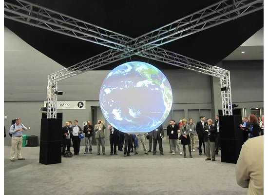
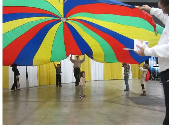
Go to flickr to see more and be sure to check back regularly for additions.
2013 Carl-Gustaf Rossby Award Recipient Strives to Deepen Our Grasp of Earth's Climate System
Dennis L. Hartmann, professor of atmospheric sciences at the University of Washington, is the 2013 recipient of the prestigious Carl-Gustaf Rossby Research Medal—meteorology’s highest honor. Dr. Hartmann is receiving this distinctive award for his significant contributions to the synthesis of knowledge of radiative and dynamical processes leading to a deeper understanding of the climate system.
The Front Page spoke with Dr. Hartmann to learn about his research and how it has evolved and become more interdisciplinary as climate change has grown increasingly important. He explained that he now focuses more on trying to understand Earth’s climate system, blending the traditional disciplines in the atmospheric sciences—radiation, dynamics, and cloud physics and chemistry—because, he said, “they are so interconnected on the long time scales associated with climate change.” With advances in technology, Dr. Hartmann utilized more and better remote sensing data from satellites to make improvements in modeling Earth’s climate—in particular, the approximate interactions between clouds and the global circulation.
“The one thing that I’ve tried to do is to look for simple, fundamental explanations for how things work and that gives us more confidence in the rather complex simulations that we do with global models.”
Click on the image below to view the interview.