A Research Spotlight from the 14th Annual Fire and Forest Meteorology Symposium, 2–4 May, 2023
The Yarnell Hill Fire the day it began, June 28, 2013. Image credit: USDA
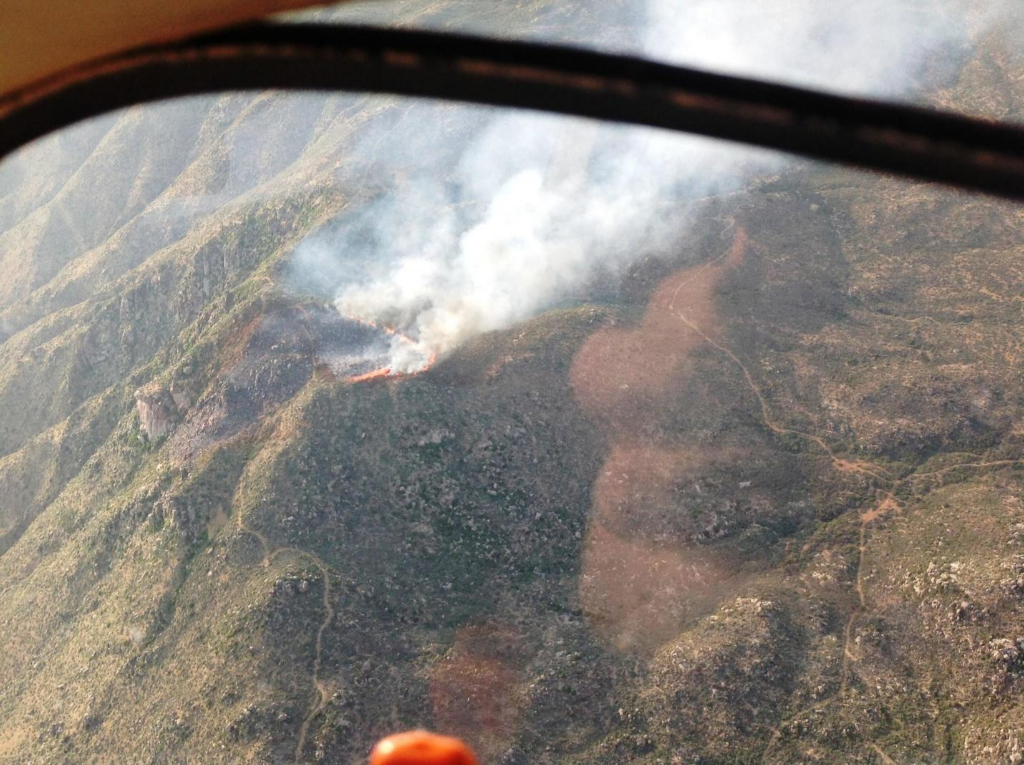
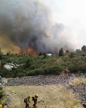
Arizona’s Yarnell Hill Fire ranks among the U.S. wildfires with the most firefighter fatalities. On June 30, 2013, members of the interagency Granite Mountain Hotshots were entrapped in a canyon by fire due to rapidly shifting wind conditions. Many attempted to take shelter but were overwhelmed. Nineteen firefighters died and the fire, fed by the strong winds, blazed out of control. The tragedy and damage devastated the community of Yarnell, Arizona.
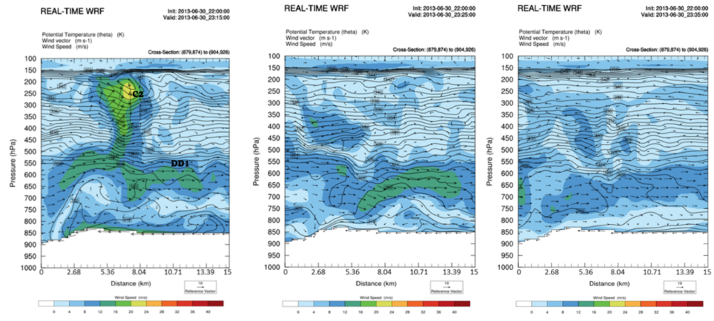
A joint team at Embry-Riddle Aeronautical University and North Carolina A&T State University has been using simulations to help understand exactly what happened. A recent presentation by Michael Kaplan et al. May 2, 2023 in the first session of the 14th Fire and Forest Meteorology Symposium broke down the events at the meso-γ (2–20 km) scale leading up to the tragedy, the latest in a series of analyses starting at large scales and moving towards ever-finer resolution. They found that a density current (a flow of denser air that intrudes underneath less-dense air) and its secondary circulations drove the winds that forced fire into the canyon where the Granite Mountain Hotshots were located.
A squall line that developed over the Colorado Plateau on the morning of the 30th moved southwestward rapidly, strengthening over the Black Hills and Bradshaw Mountains on the way, until it died out further to the southwest over the Weaver Mountains near Yarnell. From this dying squall line developed a density current that produced unusual air circulation patterns in combination with the area’s complex terrain. Simulations by the Weather Research and Forecasting (WRF) model suggest that the fading density current created conditions in the Weaver Mountains that were highly conducive to downward air motion. This resulted in a series of strong localized downdrafts similar to microbursts near the fire site.
Earlier in the day, the fire had been moving towards the northeast, driven by southwesterly winds. Within 1–2 hours in the late afternoon, the winds shifted and intensified rapidly, becoming northwesterly, then northeasterly, blowing at 45 miles per hour and driving the fire (now blazing at 2,000 degrees Fahrenheit), in a southwesterly direction. Kaplan called these shifts “dramatic, remarkable changes.”
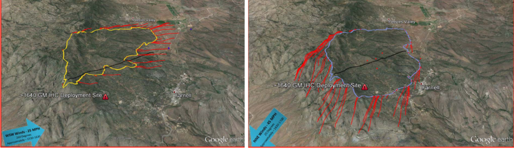
In the end, “The entrapment of the Granite Mountain Hotshots was likely the result of very, very intense redirected winds” that continued over a longer than expected period, Kaplan said. “Even after they got the initial surge of northeasterly flow [due to the density current] the Hotshots had to deal with more surges of high momentum” from the series of microbursts. He noted that despite the Granite Mountain Hotshots’ high level of experience, “This is something firefighters may not have really been [expecting] to occur.”
Kaplan’s team will continue to work on their simulations of conditions associated with the Yarnell Hill Fire, with the hope of providing information that can help prevent similar entrapments, and deaths, in the future.
Meeting registrants can view the recording of this session here. Recordings become publicly available three months after the meeting.
__________________________________________________________________________________
About 14Fire
Meteorology and wildfires are intimately interconnected—and wildfires are becoming increasingly severe and frequent in many parts of the United States. From local residents and firefighters on the ground to planners and insurers, to people hundreds of miles away breathing wind-driven smoke, society relies on our ever-improving ability to understand and forecast the atmospheric conditions relating to wildfire. The American Meteorological Society’s 14th Fire and Forest Meteorology Symposium brought together researchers and fire managers to discuss the latest science.